Area Overview for NE40 4DY
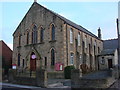
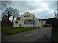
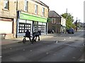
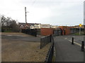
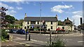
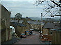
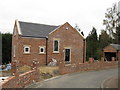
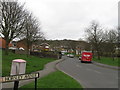
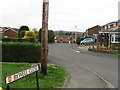
Photos of NE40 4DY

Area Information
Living in NE40 4DY means being part of a tightly knit residential cluster in England, where 1,710 people reside across 9,371 square metres. The area’s compact size fosters a sense of familiarity, with a population density of 1,369 people per square kilometre. This postcode is characterised by a mature demographic, with a median age of 47 and a majority of residents aged 30–64. Daily life here is shaped by proximity to essential services, including five retail outlets such as Morrisons Daily and Co-op Crawcrook, and easy access to rail stations like Wylam and Blaydon. The area’s low flood risk and below-average crime rates—scoring 84 out of 100 for safety—make it an attractive option for those prioritising security. While the housing stock is predominantly owner-occupied, with 80% of homes owned by residents, the small footprint of the area means properties are closely spaced. For buyers, this presents a chance to settle in a community where practicality and safety are prioritised, though the limited space may require careful consideration of long-term needs.
- Area Type
- Postcode
- Area Size
- 9371 m²
- Population
- 1710
- Population Density
- 1369 people/km²
The property market in NE40 4DY is dominated by owner-occupied homes, with 80% of properties owned by residents rather than rented. This indicates a community that values long-term investment in housing, likely contributing to a stable market with limited turnover. The accommodation type is predominantly houses, which contrasts with areas where flats or apartments predominate. This suggests a focus on family-friendly living, with homes likely offering more space and privacy than smaller units. Given the area’s small size—covering just 9,371 square metres—the housing stock is limited, which may mean properties are closely spaced. For buyers, this presents both opportunities and challenges: the area’s compact nature could mean fewer choices, but the high ownership rate and low crime risk may make it appealing for those seeking a secure, established neighbourhood. Proximity to rail and metro stations also enhances its appeal for commuters.
House Prices in NE40 4DY
Showing 29 properties
| Address | Type | Beds | Baths | Last Sale Price | Last Sale Date | |
|---|---|---|---|---|---|---|
| 1 Fell View, Crawcrook, Ryton, NE40 4DY | Terraced | 2 | 1 | £102,000 | Aug 2025 | |
| Glencoe, Greenside Road, Ryton, NE40 4DY | Bungalow | - | - | £125,000 | Jun 2024 | |
| 19 Fell View, Crawcrook, Ryton, NE40 4DY | Terraced | 3 | 1 | £134,000 | Jan 2024 | |
| 15 Fell View, Crawcrook, Ryton, NE40 4DY | Terraced | 2 | 1 | £126,000 | Oct 2022 | |
| 12 Fell View, Crawcrook, Ryton, NE40 4DY | Terraced | 2 | 1 | £81,000 | Feb 2022 | |
| 13 Fell View, Crawcrook, Ryton, NE40 4DY | Terraced | 2 | 1 | £111,000 | Apr 2021 | |
| 18 Fell View, Crawcrook, Ryton, NE40 4DY | Terraced | 2 | 1 | £110,000 | Aug 2020 | |
| Delmont, Greenside Road, Ryton, NE40 4DY | Bungalow | 3 | 2 | £138,500 | Jun 2020 | |
| 2 Fell View, Crawcrook, Ryton, NE40 4DY | house | 2 | 1 | £95,000 | Mar 2019 | |
| Oakworth House, Greenside Road, Ryton, NE40 4DY | house | - | - | £210,000 | Dec 2018 |
Energy Efficiency in NE40 4DY
Residents of NE40 4DY have access to a range of amenities within practical reach, enhancing daily life. Retail options include Morrisons Daily and Co-op outlets such as Co-op Crawcrook and Co-op Ryton, providing convenience for grocery shopping. The area’s rail stations—Wylam, Blaydon, and Prudhoe—offer easy access to regional transport networks, while metro stops like Callerton Parkway and Kingston Park connect to local routes. Though the data does not specify parks or leisure facilities, the proximity to rail and retail suggests a balance between practicality and accessibility. The presence of multiple retail and transport hubs implies a lifestyle that prioritises efficiency, with minimal need to travel far for essentials. For families, the combination of shops, schools (not named but implied by the population profile), and transport links creates a functional environment. However, the lack of specific details on green spaces or recreational areas means those prioritising outdoor activities may need to look beyond the immediate vicinity.
Amenities
Schools
| Rank | School | Type | Entry gender | Ages |
|---|
Explore more schools in this area
Go to Schools tabDemographics
The community in NE40 4DY is defined by its mature age profile, with a median age of 47 and the largest group of residents falling within the 30–64 age range. This suggests a stable population with a focus on family homes, reflected in the 80% home ownership rate. The area is predominantly composed of houses, indicating a preference for standalone properties over flats or apartments. The predominant ethnic group is White, which aligns with broader regional trends. With 1,710 residents spread across 9,371 square metres, the population density of 1,369 people per square kilometre is notably high for a residential area, suggesting compact living conditions. This density may impact availability of private outdoor space, though it also fosters a close-knit community. The data does not indicate significant deprivation, but the high ownership rate and age profile suggest a population that values stability over transient living.
Household Size
Accommodation Type
Tenure
Ethnic Group
Religion
Household Composition
Age
Household Deprivation
NS-SEC
Explore more demographic insights in this area
Go to Demographics tabPlanning
Planning Constraints
- Flood RiskPremium
- Ramsar Wetland SitesPremium
- Area of Outstanding Natural BeautyPremium
- Protected Nature ReservePremium
- Protected WoodlandPremium