Area Overview for NE40 3LF
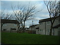
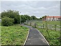
Photos of NE40 3LF
Area Information
NE40 3LF is a small residential cluster in England, covering 4.4 hectares and home to 1,503 people. Its compact size means it feels intimate, with a population density of 1,112 people per square kilometre. Daily life here is shaped by its proximity to nearby towns and transport links, making it a practical choice for those seeking a balance between rural tranquillity and urban accessibility. The area’s demographics suggest a community skewed towards older residents, with a median age of 47 and a significant proportion of those aged 65 and over. This profile may appeal to retirees or those seeking a quieter lifestyle. The postcode’s small footprint means amenities are concentrated, with local shops, transport hubs, and schools within easy reach. While it lacks the density of a larger town, its manageable scale ensures a sense of familiarity for residents. For buyers, this area offers a snapshot of northern England’s suburban character, where homes are predominantly owner-occupied and the local environment is defined by proximity to essential services.
- Area Type
- Postcode
- Area Size
- 4.4 hectares
- Population
- 1503
- Population Density
- 1112 people/km²
The property market in NE40 3LF is characterised by high home ownership (83%) and a focus on houses rather than flats or apartments. This suggests a community where long-term residency is the norm, with properties likely to be family homes or retirement residences. The small area size means the housing stock is limited, which could make the market competitive for buyers. The absence of rental properties indicates a lower turnover rate, meaning opportunities for investment or purchase may be constrained by the number of available homes. For buyers, this area offers a chance to own a house in a compact, well-served postcode, though the limited size of the area means the immediate surroundings are critical for assessing additional options. The predominance of owner-occupied homes also implies a stable market, where properties are less likely to be vacant or subject to frequent price fluctuations.
House Prices in NE40 3LF
Showing 40 properties
| Address | Type | Beds | Baths | Last Sale Price | Last Sale Date | |
|---|---|---|---|---|---|---|
| 24 Grange Drive, Ryton Central, Ryton, NE40 3LF | Semi-detached | 3 | 1 | £248,500 | Jun 2025 | |
| 22 Grange Drive, Ryton Central, Ryton, NE40 3LF | house | - | - | £165,000 | Nov 2024 | |
| 9 Grange Drive, Ryton Central, Ryton, NE40 3LF | Semi-detached | 2 | 1 | £190,000 | Sep 2024 | |
| 34 Grange Drive, Ryton Central, Ryton, NE40 3LF | Terraced | 3 | 1 | £190,000 | Aug 2024 | |
| 31 Grange Drive, Ryton Central, Ryton, NE40 3LF | Semi-detached | 4 | 3 | £280,000 | Jan 2024 | |
| 30 Grange Drive, Ryton Central, Ryton, NE40 3LF | Semi-detached | 3 | 1 | £235,000 | Dec 2022 | |
| 1A Grange Drive, Ryton Central, Ryton, NE40 3LF | Bungalow | - | - | £305,400 | Nov 2022 | |
| 10 Grange Drive, Ryton Central, Ryton, NE40 3LF | Semi-detached | 3 | 1 | £213,500 | Oct 2022 | |
| 25 Grange Drive, Ryton Central, Ryton, NE40 3LF | Detached | 3 | 1 | £205,500 | Aug 2022 | |
| 4 Grange Drive, Ryton Central, Ryton, NE40 3LF | Semi-detached | 3 | 1 | £200,000 | Sep 2020 |
Energy Efficiency in NE40 3LF
Living in NE40 3LF provides access to a range of nearby amenities, including five retail outlets such as Co-op Ryton, Co-op Crawcrook, and Morrisons Daily, which cater to everyday shopping needs. The area’s proximity to railway stations like Blaydon and Wylam, along with metro stops like Kingston Park, ensures convenient travel for work or leisure. While the data does not mention specific parks or leisure facilities, the presence of multiple transport hubs suggests the area is well-integrated with surrounding towns for dining, entertainment, and cultural activities. The compact nature of the postcode means amenities are concentrated, reducing the need for long commutes. This balance of retail, transport, and connectivity contributes to a practical lifestyle, where residents can access essentials without leaving the immediate vicinity.
Amenities
Schools
The nearest school to NE40 3LF is Crookhill Community Primary School, which provides education for younger children and holds a ‘good’ Ofsted rating. This school is the only primary education option listed in the data, suggesting that families in the area rely on it for their children’s early education. The absence of secondary schools or other educational institutions within the postcode means parents may need to consider nearby towns for secondary schooling. The presence of a rated primary school is a positive factor for families prioritising local education, though the limited range of schools could be a consideration for those requiring a broader selection. The ‘good’ rating indicates a satisfactory standard of teaching and facilities, which is reassuring for prospective homebuyers with children.
| Rank | School | Type | Entry gender | Ages |
|---|
Explore more schools in this area
Go to Schools tabDemographics
The community in NE40 3LF is predominantly elderly, with 65+ years being the most common age range. The median age of 47 reflects a population where older residents outnumber younger ones, which may influence local services and social dynamics. Home ownership is high at 83%, indicating a stable, long-term resident base rather than a transient rental market. The accommodation type is primarily houses, which aligns with the area’s small size and the preference for single-family homes. The predominant ethnic group is White, with no data provided on other ethnicities. This demographic profile suggests a community with established roots, where intergenerational living may be common. The lack of specific data on deprivation or diversity means the area’s socio-economic context remains partially opaque, but the high home ownership rate and age profile imply a relatively settled, low-turnover environment.
Household Size
Accommodation Type
Tenure
Ethnic Group
Religion
Household Composition
Age
Household Deprivation
NS-SEC
Explore more demographic insights in this area
Go to Demographics tabPlanning
Planning Constraints
- Flood RiskPremium
- Ramsar Wetland SitesPremium
- Area of Outstanding Natural BeautyPremium
- Protected Nature ReservePremium
- Protected WoodlandPremium