Area Overview for NE34 9ER
Photos of NE34 9ER
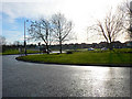
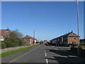
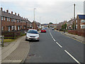
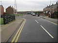
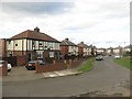
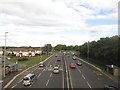
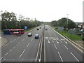
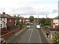
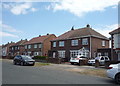
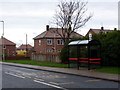


14 photos from this area
Area Information
Key information about the NE34 9ER including its size, population, and administrative classification.
- Area Type
- Postcode
- Area Size
- 1.2 hectares
- Population
- 1480
- Population Density
- 4785 people/km²
House Prices in NE34 9ER
24
Properties
£72,715
Average Sold Price
£25,725
Lowest Price
£112,500
Highest Price
Showing 24 properties
| Address | Type | Beds | Baths | Last Sale Price | Last Sale Date | |
|---|---|---|---|---|---|---|
| 195 Newcastle Road, South Shields, NE34 9ER | Semi-detached | 2 | 1 | £90,000 | May 2025 | |
| 183 Newcastle Road, South Shields, NE34 9ER | Terraced | 2 | 1 | £75,000 | Mar 2024 | |
| 187 Newcastle Road, South Shields, NE34 9ER | house | 2 | 1 | £112,500 | Mar 2023 | |
| 221 Newcastle Road, South Shields, NE34 9ER | Terraced | 2 | 1 | £95,000 | Apr 2022 | |
| 191 Newcastle Road, South Shields, NE34 9ER | Retail | 2 | 1 | £85,000 | Jan 2022 | |
| 199 Newcastle Road, South Shields, NE34 9ER | house | - | - | £81,000 | Oct 2021 | |
| 217 Newcastle Road, South Shields, NE34 9ER | house | - | - | £75,000 | May 2021 | |
| 207 Newcastle Road, South Shields, NE34 9ER | Terraced | 2 | 1 | £78,500 | Jul 2019 | |
| 213 Newcastle Road, South Shields, NE34 9ER | Terraced | 2 | 1 | £75,000 | Aug 2018 | |
| 215 Newcastle Road, South Shields, NE34 9ER | Terraced | 2 | 1 | £77,500 | Feb 2016 |
Page 1 of 3
Energy Efficiency in NE34 9ER
Amenities
Schools
| Rank | School | Type | Entry gender | Ages |
|---|
Explore more schools in this area
Go to Schools tabDemographics
Household Size
One person
most common
Accommodation Type
Houses
most common
Tenure
45
majority
Ethnic Group
White
most common
Religion
N/A
most common
Household Composition
N/A
most common
Age
47
median
Adults (30-64 years)
most common
Household Deprivation
N/A
with no deprivation
NS-SEC
15
in Lower managerial occupations
Explore more demographic insights in this area
Go to Demographics tabPlanning
Planning Constraints
- Flood RiskPremium
- Ramsar Wetland SitesPremium
- Area of Outstanding Natural BeautyPremium
- Protected Nature ReservePremium
- Protected WoodlandPremium