Area Overview for NE34 9EN
Photos of NE34 9EN
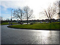
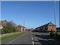
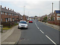
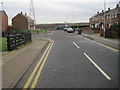
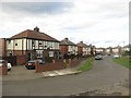
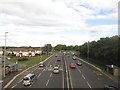
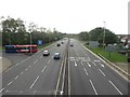
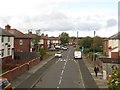
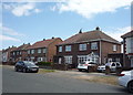
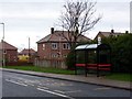


14 photos from this area
Area Information
Key information about the NE34 9EN including its size, population, and administrative classification.
- Area Type
- Postcode
- Area Size
- 2.1 hectares
- Population
- 1480
- Population Density
- 70604 people/km²
House Prices in NE34 9EN
56
Properties
£71,900
Average Sold Price
£33,000
Lowest Price
£100,000
Highest Price
Showing 56 properties
| Address | Type | Beds | Baths | Last Sale Price | Last Sale Date | |
|---|---|---|---|---|---|---|
| 41 Peel Gardens, South Shields, NE34 9EN | Terraced | 2 | 1 | £90,000 | Jul 2024 | |
| 38 Peel Gardens, South Shields, NE34 9EN | Terraced | 2 | - | £100,000 | May 2024 | |
| 33 Peel Gardens, South Shields, NE34 9EN | Terraced | 2 | 1 | £90,700 | May 2020 | |
| 47 Peel Gardens, South Shields, NE34 9EN | house | - | - | £90,000 | Mar 2020 | |
| 27 Peel Gardens, South Shields, NE34 9EN | Terraced | 2 | 1 | £62,500 | Feb 2020 | |
| 48 Peel Gardens, South Shields, NE34 9EN | house | - | - | £88,000 | Mar 2019 | |
| 39 Peel Gardens, South Shields, NE34 9EN | Terraced | 2 | 1 | £74,000 | Nov 2018 | |
| 21 Peel Gardens, South Shields, NE34 9EN | house | 2 | - | £87,000 | Aug 2018 | |
| 52 Peel Gardens, South Shields, NE34 9EN | Semi-detached | 3 | 1 | £75,000 | May 2018 | |
| 18 Peel Gardens, South Shields, NE34 9EN | house | - | - | £73,000 | Apr 2018 |
Page 1 of 6
Energy Efficiency in NE34 9EN
Amenities
Schools
| Rank | School | Type | Entry gender | Ages |
|---|
Explore more schools in this area
Go to Schools tabDemographics
Household Size
One person
most common
Accommodation Type
Houses
most common
Tenure
45
majority
Ethnic Group
White
most common
Religion
N/A
most common
Household Composition
N/A
most common
Age
47
median
Adults (30-64 years)
most common
Household Deprivation
N/A
with no deprivation
NS-SEC
15
in Lower managerial occupations
Explore more demographic insights in this area
Go to Demographics tabPlanning
Planning Constraints
- Flood RiskPremium
- Ramsar Wetland SitesPremium
- Area of Outstanding Natural BeautyPremium
- Protected Nature ReservePremium
- Protected WoodlandPremium