Area Overview for NE32 4HL
Photos of NE32 4HL
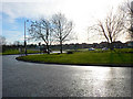
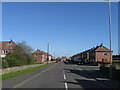
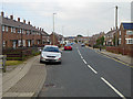
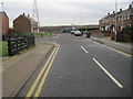
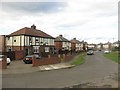
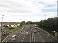
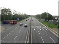
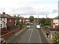
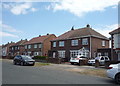
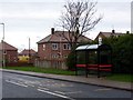


14 photos from this area
Area Information
Key information about the NE32 4HL including its size, population, and administrative classification.
- Area Type
- Postcode
- Area Size
- 7259 m²
- Population
- 1421
- Population Density
- 4476 people/km²
House Prices in NE32 4HL
24
Properties
£67,187
Average Sold Price
£40,000
Lowest Price
£95,000
Highest Price
Showing 24 properties
| Address | Type | Beds | Baths | Last Sale Price | Last Sale Date | |
|---|---|---|---|---|---|---|
| 9 Selkirk Street, Jarrow, NE32 4HL | Maisonette | - | - | £74,000 | May 2024 | |
| 13 Selkirk Street, Jarrow, NE32 4HL | Flat | - | - | £40,000 | Mar 2020 | |
| 12 Selkirk Street, Jarrow, NE32 4HL | Flat | - | - | £56,000 | Oct 2014 | |
| 4 Selkirk Street, Jarrow, NE32 4HL | house | 3 | - | £58,500 | Jul 2011 | |
| 2 Selkirk Street, Jarrow, NE32 4HL | Semi-detached | - | - | £57,500 | Nov 2006 | |
| 19 Selkirk Street, Jarrow, NE32 4HL | house | 3 | - | £83,500 | Sep 2006 | |
| 7 Selkirk Street, Jarrow, NE32 4HL | Semi-detached | - | - | £95,000 | Mar 2006 | |
| 1 Selkirk Street, Jarrow, NE32 4HL | Semi-detached | - | - | £72,995 | Apr 2004 | |
| 22 Selkirk Street, Jarrow, NE32 4HL | house | 3 | - | - | - | |
| 15 Selkirk Street, Jarrow, NE32 4HL | house | - | - | - | - |
Page 1 of 3
Energy Efficiency in NE32 4HL
Amenities
Schools
| Rank | School | Type | Entry gender | Ages |
|---|
Explore more schools in this area
Go to Schools tabDemographics
Household Size
Two person
most common
Accommodation Type
Houses
most common
Tenure
40
majority
Ethnic Group
White
most common
Religion
N/A
most common
Household Composition
N/A
most common
Age
47
median
Adults (30-64 years)
most common
Household Deprivation
N/A
with no deprivation
NS-SEC
17
in Lower managerial occupations
Explore more demographic insights in this area
Go to Demographics tabPlanning
Planning Constraints
- Flood RiskPremium
- Ramsar Wetland SitesPremium
- Area of Outstanding Natural BeautyPremium
- Protected Nature ReservePremium
- Protected WoodlandPremium