Area Overview for NE32 4BD
Photos of NE32 4BD
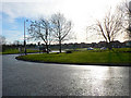
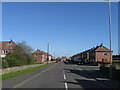
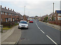
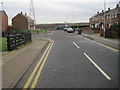
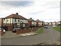
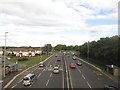
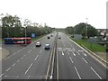
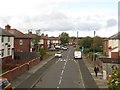
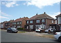
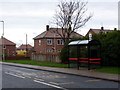


14 photos from this area
Area Information
Key information about the NE32 4BD including its size, population, and administrative classification.
- Area Type
- Postcode
- Area Size
- 1.1 hectares
- Population
- 1421
- Population Density
- 4476 people/km²
House Prices in NE32 4BD
33
Properties
£89,885
Average Sold Price
£38,000
Lowest Price
£142,000
Highest Price
Showing 33 properties
| Address | Type | Beds | Baths | Last Sale Price | Last Sale Date | |
|---|---|---|---|---|---|---|
| 43 Edinburgh Road, Jarrow, NE32 4BD | Semi-detached | 3 | 1 | £142,000 | Jun 2025 | |
| 42 Edinburgh Road, Jarrow, NE32 4BD | house | 3 | - | £110,000 | Nov 2023 | |
| 51 Edinburgh Road, Jarrow, NE32 4BD | Flat | 2 | 1 | £65,500 | Jun 2022 | |
| 54 Edinburgh Road, Jarrow, NE32 4BD | house | - | - | £83,000 | Jun 2021 | |
| 58 Edinburgh Road, Jarrow, NE32 4BD | Semi-detached | 2 | 1 | £127,000 | Feb 2021 | |
| 66 Edinburgh Road, Jarrow, NE32 4BD | Semi-detached | 3 | 2 | £100,000 | Mar 2020 | |
| 56 Edinburgh Road, Jarrow, NE32 4BD | Semi-detached | 2 | - | £78,500 | Nov 2016 | |
| 41 Edinburgh Road, Jarrow, NE32 4BD | Semi-detached | 3 | - | £70,000 | Aug 2016 | |
| 68 Edinburgh Road, Jarrow, NE32 4BD | Semi-detached | 3 | - | £110,000 | Nov 2015 | |
| 40 Edinburgh Road, Jarrow, NE32 4BD | Semi-detached | 3 | - | £82,500 | Sep 2014 |
Page 1 of 4
Energy Efficiency in NE32 4BD
Amenities
Schools
| Rank | School | Type | Entry gender | Ages |
|---|
Explore more schools in this area
Go to Schools tabDemographics
Household Size
Two person
most common
Accommodation Type
Houses
most common
Tenure
40
majority
Ethnic Group
White
most common
Religion
N/A
most common
Household Composition
N/A
most common
Age
47
median
Adults (30-64 years)
most common
Household Deprivation
N/A
with no deprivation
NS-SEC
17
in Lower managerial occupations
Explore more demographic insights in this area
Go to Demographics tabPlanning
Planning Constraints
- Flood RiskPremium
- Ramsar Wetland SitesPremium
- Area of Outstanding Natural BeautyPremium
- Protected Nature ReservePremium
- Protected WoodlandPremium