Area Overview for NE32 4AP
Photos of NE32 4AP
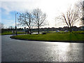
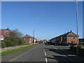
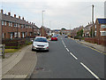
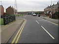
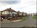
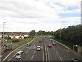
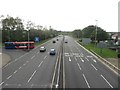
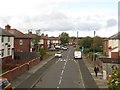
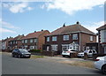
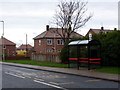


14 photos from this area
Area Information
Key information about the NE32 4AP including its size, population, and administrative classification.
- Area Type
- Postcode
- Area Size
- 5486 m²
- Population
- 1351
- Population Density
- 246258 people/km²
House Prices in NE32 4AP
24
Properties
£48,170
Average Sold Price
£17,500
Lowest Price
£72,250
Highest Price
Showing 24 properties
| Address | Type | Beds | Baths | Last Sale Price | Last Sale Date | |
|---|---|---|---|---|---|---|
| 62 Glasgow Road, Jarrow, NE32 4AP | Flat | - | - | £40,750 | Jun 2024 | |
| 52 Glasgow Road, Jarrow, NE32 4AP | Flat | 2 | 1 | £72,250 | Mar 2022 | |
| 69 Glasgow Road, Jarrow, NE32 4AP | Flat | 2 | 1 | £52,500 | Mar 2022 | |
| 72 Glasgow Road, Jarrow, NE32 4AP | Flat | - | - | £47,500 | Oct 2019 | |
| 64 Glasgow Road, Jarrow, NE32 4AP | Flat | - | - | £39,000 | Oct 2019 | |
| 54 Glasgow Road, Jarrow, NE32 4AP | Flat | 1 | - | £47,000 | Aug 2016 | |
| 76 Glasgow Road, Jarrow, NE32 4AP | Semi-detached | 3 | 1 | £63,200 | Oct 2015 | |
| 63 Glasgow Road, Jarrow, NE32 4AP | Flat | - | - | £42,000 | Mar 2012 | |
| 70 Glasgow Road, Jarrow, NE32 4AP | Flat | - | - | £60,000 | Jun 2008 | |
| 66 Glasgow Road, Jarrow, NE32 4AP | Flat | 2 | 1 | £17,500 | Jul 2002 |
Page 1 of 3
Energy Efficiency in NE32 4AP
Amenities
Schools
| Rank | School | Type | Entry gender | Ages |
|---|
Explore more schools in this area
Go to Schools tabDemographics
Household Size
One person
most common
Accommodation Type
Houses
most common
Tenure
40
majority
Ethnic Group
White
most common
Religion
N/A
most common
Household Composition
N/A
most common
Age
47
median
Adults (30-64 years)
most common
Household Deprivation
N/A
with no deprivation
NS-SEC
18
in Lower managerial occupations
Explore more demographic insights in this area
Go to Demographics tabPlanning
Planning Constraints
- Flood RiskPremium
- Ramsar Wetland SitesPremium
- Area of Outstanding Natural BeautyPremium
- Protected Nature ReservePremium
- Protected WoodlandPremium