Area Overview for NE32 3UX
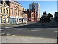
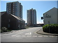
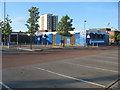
Photos of NE32 3UX

Area Information
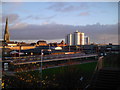
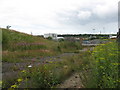
Living in NE32 3UX means being part of a compact, residential cluster in England with a population of 1,599 spread across 3,359 square metres. The area’s population density of 967 people per square kilometre suggests a tightly knit community, though its small size means it is not a sprawling suburb. The area’s character is shaped by its modest scale and proximity to nearby towns, offering a balance between residential calm and access to regional services. With a median age of 47 and a majority of residents aged 30–64, the community is largely composed of working-age adults, many of whom may be employed in nearby industries or commuting to larger cities. Daily life here is likely defined by routine, with residents relying on nearby amenities for shopping, transport, and leisure. The area’s small footprint means it is not a destination for large-scale development, but its proximity to rail, ferry, and road networks ensures connectivity to broader opportunities.
- Area Type
- Postcode
- Area Size
- 3359 m²
- Population
- 1599
- Population Density
- 967 people/km²
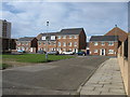
The property market in NE32 3UX is characterised by a low home ownership rate of 27%, suggesting that the majority of housing stock is occupied by renters. The accommodation type is predominantly houses, which may indicate a focus on family homes or larger properties. However, the small area size and limited data on property types mean the market is likely constrained, with fewer options for buyers compared to larger towns. For those considering purchase, the low home ownership rate could signal a rental-heavy market, potentially affecting property value growth. The presence of houses may appeal to families, but the area’s compact nature means buyers must weigh proximity to amenities against limited space. Immediate surroundings may offer more variety, but NE32 3UX itself is unlikely to be a hotspot for property speculation.
House Prices in NE32 3UX
Showing 1 properties
| Address | Type | Beds | Baths | Last Sale Price | Last Sale Date | |
|---|---|---|---|---|---|---|
| Dencall, Palmer Community Hospital, Wear Street, Jarrow, NE32 3UX | commercial | - | - | - | - |
Energy Efficiency in NE32 3UX
Life in NE32 3UX is supported by a range of amenities within easy reach. Retailers such as Iceland Jarrow, Morrisons Jarrow, and Morrisons Daily provide essential shopping options, while nearby rail stations like Brockley Whins and Heworth connect residents to broader networks. The area’s proximity to ferry terminals at Newcastle International and South Shields offers access to maritime travel and coastal destinations. Metro stations at Jarrow, Howdon, and Bede add flexibility for commuting. For leisure, the presence of multiple rail and bus stops suggests opportunities for travel beyond the immediate area. While the data does not specify parks or recreational spaces, the variety of transport and retail options implies a functional lifestyle, with residents able to access both local conveniences and regional opportunities.
Amenities
Schools
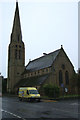
The nearest school to NE32 3UX is St Peter’s CofE Primary School, a primary institution serving the area. While no Ofsted rating is provided, the presence of a single primary school suggests that families in the area may need to look beyond NE32 3UX for secondary education options. The school’s location within practical reach of residents indicates it is a key local resource, though the lack of additional schools in the data means the area may not cater to all stages of education. Parents should consider the need for transport to secondary schools in nearby towns, as the current school infrastructure is limited to primary level.
| Rank | School | Type | Entry gender | Ages |
|---|
Explore more schools in this area
Go to Schools tabDemographics
The demographics of NE32 3UX reflect a mature, predominantly White population, with a median age of 47 and the largest age group being adults aged 30–64. This suggests a community with a strong presence of middle-aged residents, many of whom may be settled in long-term housing. Home ownership is relatively low at 27%, indicating that a significant proportion of residents live in rental properties. The accommodation type is primarily houses, which contrasts with the low home ownership rate, hinting at a mix of private rentals and possibly social housing. The area’s demographic profile, with no specific data on deprivation, implies a stable but not necessarily affluent population. The absence of detailed diversity metrics means the community is likely homogenous, though this could change as local dynamics evolve.
Household Size
Accommodation Type
Tenure
Ethnic Group
Religion
Household Composition
Age
Household Deprivation
NS-SEC
Explore more demographic insights in this area
Go to Demographics tabPlanning
Planning Constraints
- Flood RiskPremium
- Ramsar Wetland SitesPremium
- Area of Outstanding Natural BeautyPremium
- Protected Nature ReservePremium
- Protected WoodlandPremium