Area Overview for NE32 3NR
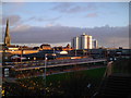
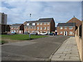
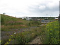
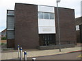
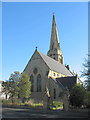
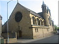
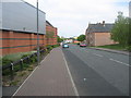
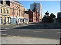
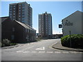
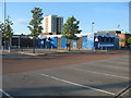
Photos of NE32 3NR


Area Information
NE32 3NR is a small, densely populated residential cluster in England, home to 1,599 people spread across a compact area. With a population density of 967 people per square kilometre, this postcode reflects a tightly knit community. The area’s character is shaped by its proximity to transport hubs and amenities, making it practical for daily life. Residents benefit from nearby retail outlets, including Iceland Jarrow and Morrisons, as well as multiple rail and metro stations. The demographic profile suggests a mature population, with a median age of 47 and a majority of adults aged 30–64. This suggests a community with established roots, likely centred around local employment or commuting to nearby urban centres. While the area lacks large-scale infrastructure, its accessibility to Newcastle and South Shields via rail and ferry terminals offers flexibility for work and leisure. For those considering living in NE32 3NR, the blend of compact living and connectivity may appeal to those prioritising convenience over expansive space.
- Area Type
- Postcode
- Area Size
- Not available
- Population
- 1599
- Population Density
- 967 people/km²
The property market in NE32 3NR is defined by a low home ownership rate of 27%, which implies a significant portion of the housing stock is rented. The accommodation type is predominantly houses, which is notable in a small postcode area, suggesting a mix of semi-detached or terraced homes. This configuration may appeal to families seeking space, though the compact nature of the area could limit availability. The low home ownership percentage indicates a rental market, potentially offering opportunities for investors or tenants. However, the small size of the area means buyers must consider nearby suburbs for more extensive property options. For those seeking owner-occupied homes, the limited supply may drive competition, particularly for houses. The market’s character is shaped by its proximity to transport links, which could influence property values based on commuting convenience.
House Prices in NE32 3NR
No properties found in this postcode.
Energy Efficiency in NE32 3NR
Living in NE32 3NR offers access to a range of amenities within practical reach. Retail options include Iceland Jarrow, Morrisons Jarrow, and Morrisons Daily, catering to grocery and household needs. The area’s proximity to rail stations like Brockley Whins and Heworth, as well as metro stops at Jarrow and Howdon, ensures easy access to employment and leisure opportunities in Newcastle and South Shields. Ferry terminals at Newcastle International and South Shields provide direct links to maritime travel. While the data does not list parks or leisure facilities, the presence of multiple transport hubs suggests the area is integrated into broader regional amenities. The mix of retail, transport, and connectivity options creates a functional lifestyle, though residents may need to travel slightly further for specialist services or recreational spaces.
Amenities
Schools
The nearest school to NE32 3NR is St Peter’s CofE Primary School, a primary institution serving the local community. No secondary schools are listed in the data, which may require families to seek options in nearby areas such as Jarrow or South Shields. The presence of a primary school suggests the area supports young families, though the absence of secondary education within the postcode could be a consideration for those prioritising convenience. The school’s type—CofE (Church of England)—may indicate a community with religious or historical ties to the church. For families relying on local education, the single primary school is a key asset, but secondary schooling would need to be arranged elsewhere. This dynamic reflects the area’s small size and its role as part of a broader regional school network.
| Rank | School | Type | Entry gender | Ages |
|---|
Explore more schools in this area
Go to Schools tabDemographics
The population of NE32 3NR is predominantly composed of adults aged 30–64, with a median age of 47. This indicates a community with a strong presence of middle-aged residents, likely with established careers and families. Home ownership in the area is relatively low at 27%, suggesting a higher proportion of rental properties. The accommodation type is primarily houses, which is unusual for a small postcode area, hinting at a mix of older, family-oriented homes. The predominant ethnic group is White, with no specific data on other groups provided. The high population density—967 people per square kilometre—suggests a compact, possibly multi-generational living environment. While the data does not include deprivation metrics, the low home ownership rate may correlate with affordability challenges, though this remains speculative. The area’s demographic profile aligns with a mature, stable community, though its small size limits the diversity of household types and age ranges.
Household Size
Accommodation Type
Tenure
Ethnic Group
Religion
Household Composition
Age
Household Deprivation
NS-SEC
Explore more demographic insights in this area
Go to Demographics tabPlanning
Planning Constraints
- Flood RiskPremium
- Ramsar Wetland SitesPremium
- Area of Outstanding Natural BeautyPremium
- Protected Nature ReservePremium
- Protected WoodlandPremium