Area Overview for NE32 3JD
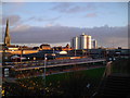
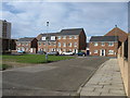
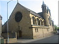
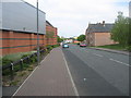
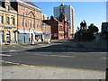
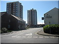
Photos of NE32 3JD


Area Information
Living in NE32 3JD means being part of a small, compact residential cluster in England, where 1,599 people reside across 670 square metres. The area’s density — 967 people per square kilometre — reflects a tightly knit community, ideal for those seeking a localised, manageable environment. This postcode is characterised by its focus on houses, with a population skewed towards adults aged 30–64, suggesting a mature, established demographic. Daily life here is shaped by proximity to essential services, including retail, transport hubs, and schools. The area’s small footprint means residents can easily access nearby amenities, from supermarkets like Iceland Jarrow to rail stations serving Jarrow and Howdon. While it lacks the sprawling sprawl of larger towns, NE32 3JD offers a balance of practicality and community, with a clear emphasis on connectivity and accessibility. For buyers, it’s a niche market where every property is within walking or short driving distance of key services, making it appealing to those prioritising convenience over expansive space.
- Area Type
- Postcode
- Area Size
- 670 m²
- Population
- 1599
- Population Density
- 967 people/km²
The property market in NE32 3JD is defined by its low home ownership rate — just 27% — and a focus on houses rather than flats or apartments. This suggests a rental-dominated market, with a limited number of owner-occupied properties. The prevalence of houses indicates a suburban, low-density character, which may appeal to buyers seeking larger living spaces or families requiring more room. However, the small area size means the housing stock is finite, and buyers may need to consider nearby postcode areas for additional options. The limited home ownership rate also implies a transient population, potentially affecting property values and long-term investment prospects. For those prioritising space and a quieter, established environment, NE32 3JD offers a niche opportunity, though competition for available properties is likely to be high given the area’s compact nature.
House Prices in NE32 3JD
Showing 1 properties
| Address | Type | Beds | Baths | Last Sale Price | Last Sale Date | |
|---|---|---|---|---|---|---|
| Ian Cruickshank And Co, 10-12 Grange Road West, Jarrow, NE32 3JD | retail_financial | - | - | - | - |
Energy Efficiency in NE32 3JD
Daily life in NE32 3JD is shaped by its proximity to a range of amenities. Retail options include Iceland Jarrow and Morrisons Jarrow, offering grocery and household essentials. The area’s transport links provide access to leisure and work opportunities, with rail stations connecting to Jarrow, Howdon, and Hebburn. Ferry terminals at Newcastle International and South Shields open up coastal travel possibilities. While the data does not list specific parks or leisure facilities, the presence of multiple transport hubs suggests a focus on practicality over expansive green spaces. The compact nature of the area means residents can reach shops, dining, and services quickly, though the absence of detailed leisure amenities may require venturing slightly further afield for recreational activities. Overall, NE32 3JD balances convenience with a modest, community-oriented lifestyle.
Amenities
Schools
The nearest school to NE32 3JD is St Peter’s CofE Primary School, which serves the local community with primary education. No secondary schools are listed in the data, meaning families with older children may need to look beyond the immediate area for secondary education. The presence of a primary school suggests that some households are focused on early education, though the absence of a secondary school could be a consideration for families planning long-term. The school’s type — a Church of England institution — may align with specific educational preferences, but its Ofsted rating is not provided, leaving its quality unassessed. For buyers prioritising schools, NE32 3JD offers a basic foundation but may require additional research into nearby secondary options.
| Rank | School | Type | Entry gender | Ages |
|---|
Explore more schools in this area
Go to Schools tabDemographics
NE32 3JD’s population of 1,599 is predominantly composed of adults aged 30–64, with a median age of 47. This suggests a community of middle-aged residents, likely established professionals or families with children. Only 27% of homes are owner-occupied, indicating a rental-heavy market, which may influence the area’s transient nature. The accommodation type is primarily houses, reflecting a low-density, suburban layout. The predominant ethnic group is White, with no data provided on other demographics. The absence of specific deprivation metrics means quality of life remains unquantified, but the age profile and housing stock suggest a stable, mature population. The high proportion of adult residents may imply fewer young families, though the presence of St Peter’s CofE Primary School indicates some households with children. The area’s demographics align with a community that values familiarity and proximity to services over rapid change.
Household Size
Accommodation Type
Tenure
Ethnic Group
Religion
Household Composition
Age
Household Deprivation
NS-SEC
Explore more demographic insights in this area
Go to Demographics tabPlanning
Planning Constraints
- Flood RiskPremium
- Ramsar Wetland SitesPremium
- Area of Outstanding Natural BeautyPremium
- Protected Nature ReservePremium
- Protected WoodlandPremium