Area Overview for NE26 2NE
Photos of NE26 2NE
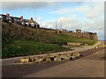
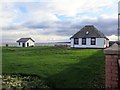
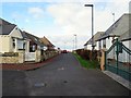
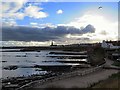
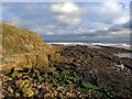
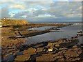
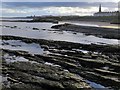
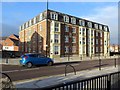
100 photos from this area
Area Information
Key information about the NE26 2NE including its size, population, and administrative classification.
- Area Type
- Postcode
- Area Size
- 3619 m²
- Population
- 1589
- Population Density
- 439011 people/km²
House Prices in NE26 2NE
22
Properties
£112,312
Average Sold Price
£25,000
Lowest Price
£222,000
Highest Price
Showing 22 properties
| Address | Type | Beds | Baths | Last Sale Price | Last Sale Date | |
|---|---|---|---|---|---|---|
| 104 Whitley Road, Whitley Bay, NE26 2NE | Maisonette | 3 | 1 | £175,000 | Dec 2024 | |
| 88 Whitley Road, Whitley Bay, NE26 2NE | Terraced | 2 | 1 | £140,000 | May 2023 | |
| 72 Whitley Road, Whitley Bay, NE26 2NE | Flat | - | - | £79,950 | Jan 2021 | |
| 80A Whitley Road, Whitley Bay, NE26 2NE | Flat | - | 1 | £81,000 | Jan 2020 | |
| 110 Whitley Road, Whitley Bay, NE26 2NE | Flat | - | - | £125,000 | Sep 2016 | |
| 106 Whitley Road, Whitley Bay, NE26 2NE | house | - | - | £168,000 | Feb 2016 | |
| 86A Whitley Road, Whitley Bay, NE26 2NE | Flat | - | - | £102,000 | Feb 2014 | |
| 78 Whitley Road, Whitley Bay, NE26 2NE | house | 3 | - | £110,110 | Nov 2010 | |
| 66 Whitley Road, Whitley Bay, NE26 2NE | Flat | - | - | £60,000 | Oct 2008 | |
| 94 Whitley Road, Whitley Bay, NE26 2NE | Flat | - | - | £222,000 | Apr 2008 |
Page 1 of 3
Energy Efficiency in NE26 2NE
Amenities
Schools
| Rank | School | Type | Entry gender | Ages |
|---|
Explore more schools in this area
Go to Schools tabDemographics
Household Size
One person
most common
Accommodation Type
Houses
most common
Tenure
69
majority
Ethnic Group
White
most common
Religion
N/A
most common
Household Composition
N/A
most common
Age
47
median
Adults (30-64 years)
most common
Household Deprivation
N/A
with no deprivation
NS-SEC
41
in Lower managerial occupations
Explore more demographic insights in this area
Go to Demographics tabPlanning
Planning Constraints
- Flood RiskPremium
- Ramsar Wetland SitesPremium
- Area of Outstanding Natural BeautyPremium
- Protected Nature ReservePremium
- Protected WoodlandPremium