Area Overview for NE11 9UB
Photos of NE11 9UB
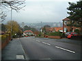
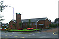
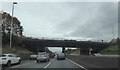
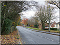
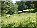
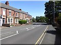
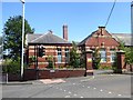
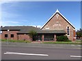
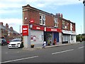
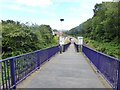
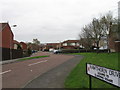
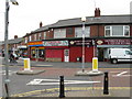
24 photos from this area
Area Information
Key information about the NE11 9UB including its size, population, and administrative classification.
- Area Type
- Postcode
- Area Size
- 5646 m²
- Population
- 1641
- Population Density
- 290629 people/km²
House Prices in NE11 9UB
20
Properties
£93,643
Average Sold Price
£31,000
Lowest Price
£177,000
Highest Price
Showing 20 properties
| Address | Type | Beds | Baths | Last Sale Price | Last Sale Date | |
|---|---|---|---|---|---|---|
| 6 Wilson Street, Dunston Hill, Gateshead, NE11 9UB | Terraced | 3 | 1 | £177,000 | Mar 2025 | |
| 3 Wilson Street, Dunston Hill, Gateshead, NE11 9UB | house | - | - | £60,000 | May 2024 | |
| 12 Wilson Street, Dunston Hill, Gateshead, NE11 9UB | Retail | 3 | 1 | £105,500 | Apr 2022 | |
| 2 Wilson Street, Dunston Hill, Gateshead, NE11 9UB | Terraced | 3 | 1 | £175,000 | Sep 2018 | |
| 17 Wilson Street, Dunston Hill, Gateshead, NE11 9UB | Terraced | 3 | 1 | £111,500 | Aug 2018 | |
| 16 Wilson Street, Dunston Hill, Gateshead, NE11 9UB | Terraced | 3 | 1 | £124,500 | Apr 2018 | |
| 15 Wilson Street, Dunston Hill, Gateshead, NE11 9UB | Terraced | 3 | 1 | £134,000 | May 2015 | |
| 13 Wilson Street, Dunston Hill, Gateshead, NE11 9UB | Terraced | 2 | 1 | £85,000 | Dec 2013 | |
| 14 Wilson Street, Dunston Hill, Gateshead, NE11 9UB | Terraced | 3 | - | £138,000 | Jul 2007 | |
| 5 Wilson Street, Dunston Hill, Gateshead, NE11 9UB | Terraced | 3 | 1 | £71,500 | Nov 2003 |
Page 1 of 2
Energy Efficiency in NE11 9UB
Amenities
Schools
| Rank | School | Type | Entry gender | Ages |
|---|
Explore more schools in this area
Go to Schools tabDemographics
Household Size
Two person
most common
Accommodation Type
Houses
most common
Tenure
66
majority
Ethnic Group
White
most common
Religion
N/A
most common
Household Composition
N/A
most common
Age
47
median
Adults (30-64 years)
most common
Household Deprivation
N/A
with no deprivation
NS-SEC
23
in Lower managerial occupations
Explore more demographic insights in this area
Go to Demographics tabPlanning
Planning Constraints
- Flood RiskPremium
- Ramsar Wetland SitesPremium
- Area of Outstanding Natural BeautyPremium
- Protected Nature ReservePremium
- Protected WoodlandPremium