Area Overview for NE11 9TL
Photos of NE11 9TL
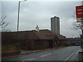
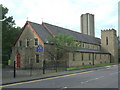
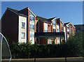
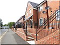
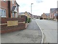
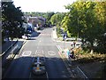

41 photos from this area
Area Information
Key information about the NE11 9TL including its size, population, and administrative classification.
- Area Type
- Postcode
- Area Size
- 8255 m²
- Population
- 1641
- Population Density
- 4647 people/km²
House Prices in NE11 9TL
23
Properties
£120,283
Average Sold Price
£48,250
Lowest Price
£225,000
Highest Price
Showing 23 properties
| Address | Type | Beds | Baths | Last Sale Price | Last Sale Date | |
|---|---|---|---|---|---|---|
| 22 Horsley Gardens, Dunston, Gateshead, NE11 9TL | Semi-detached | 3 | 1 | £225,000 | Jul 2023 | |
| 10 Horsley Gardens, Dunston, Gateshead, NE11 9TL | Semi-detached | 3 | 1 | £212,000 | Jul 2023 | |
| 20 Horsley Gardens, Dunston, Gateshead, NE11 9TL | Semi-detached | 3 | 1 | £140,000 | Apr 2018 | |
| 28 Horsley Gardens, Dunston, Gateshead, NE11 9TL | Semi-detached | 3 | - | £160,000 | Jun 2006 | |
| 18 Horsley Gardens, Dunston, Gateshead, NE11 9TL | Terraced | - | - | £120,000 | Oct 2005 | |
| 24 Horsley Gardens, Dunston, Gateshead, NE11 9TL | Terraced | - | - | £63,350 | Dec 2001 | |
| 25 Horsley Gardens, Dunston, Gateshead, NE11 9TL | Semi-detached | - | - | £54,000 | Apr 1999 | |
| 23 Horsley Gardens, Dunston, Gateshead, NE11 9TL | Semi-detached | - | - | £48,250 | Feb 1999 | |
| 13 Horsley Gardens, Dunston, Gateshead, NE11 9TL | Terraced | - | - | £59,950 | Nov 1997 | |
| 8 Horsley Gardens, Dunston, Gateshead, NE11 9TL | Detached | - | - | - | - |
Page 1 of 3
Energy Efficiency in NE11 9TL
Amenities
Schools
| Rank | School | Type | Entry gender | Ages |
|---|
Explore more schools in this area
Go to Schools tabDemographics
Household Size
Two person
most common
Accommodation Type
Houses
most common
Tenure
66
majority
Ethnic Group
White
most common
Religion
N/A
most common
Household Composition
N/A
most common
Age
47
median
Adults (30-64 years)
most common
Household Deprivation
N/A
with no deprivation
NS-SEC
23
in Lower managerial occupations
Explore more demographic insights in this area
Go to Demographics tabPlanning
Planning Constraints
- Flood RiskPremium
- Ramsar Wetland SitesPremium
- Area of Outstanding Natural BeautyPremium
- Protected Nature ReservePremium
- Protected WoodlandPremium