Area Overview for Wheatley Hill
Photos of Wheatley Hill

Area Information
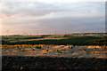
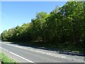
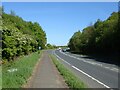
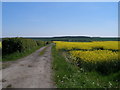
Living in Wheatley Hill means residing in a small civil parish within County Durham, North East England. This area covers 5.9 km² and forms part of the Trimdon and Thornley electoral ward. Originally known as Quetlaw Village and later Whitelaw, the community evolved significantly after a coal mine opened in 1861. Mining activity led to substantial growth before the pit closed in 1968, a date that marks a pivotal moment in local history for many residents. The name itself possibly derives from references to grain, hoar frost on the land, or the landscape feature of a law. Today, the parish retains a strong sense of community spirit supported by active local governance. Residents benefit from quality services and a wealth of preserved mining heritage that defines the character of the village. The Wheatley Hill Heritage Centre serves as a focal point, showcasing local history through a converted Edwardian chapel of rest. This location offers a distinct pace of life for those seeking connection to North East England's industrial past. The area provides specific historical context through its lineage, first mentioned in 1451, progressing through centuries of family land transactions to its current status as a former mining village with a unified identity.
- Area Type
- Parish
- Area Size
- 5.9 km²
- Population
- Not available
- Population Density
- Not available
Demographics
The community in Wheatley Hill reflects a mature population profile suitable for experienced homebuyers. The median age here stands at 70, indicating that the area is predominantly inhabited by older generations. Your neighbours in Wheatley Hill are likely to be retirees seeking a quieter lifestyle away from urban centres. With 59 per cent home ownership, the majority of households own their residences outright or with a mortgage. This high ownership rate suggests a stable local population deeply rooted in the parish. The demographic data does not specify household composition breakdowns or predominant ethnic groups in the available records. Similarly, detailed religious affiliation statistics are not included in the current profile. The absence of specific figures on age ranges beyond the median prevents a granular analysis of younger family units. Despite these missing details, the overarching picture is one of an older, owner-occupied community. Potential buyers seeking a quiet environment with a settled demographic will find Wheatley Hill aligns with these preferences. The high ownership percentage reinforces the stability of the local populace, making it a suitable choice for those prioritising long-term residency over rapid turnover or youthful vibrancy in the immediate neighbourhood.
Household Size
Accommodation Type
Tenure
Ethnic Group
Religion
Household Composition
Age
Household Deprivation
NS-SEC
Explore more demographic insights in this area
Go to Demographics tabPlanning
Planning Constraints
- Flood RiskPremium
- Ramsar Wetland SitesPremium
- Area of Outstanding Natural BeautyPremium
- Protected Nature ReservePremium
- Protected WoodlandPremium