Area Overview for Thornley
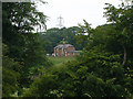
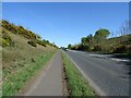
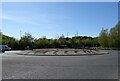
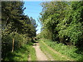
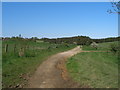
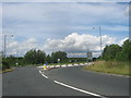
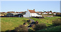
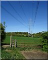
Photos of Thornley
Area Information
Living in Thornley offers a quiet existence within a compact civil parish. The area covers just 4.6 km², creating an extensive residential landscape where neighbours often know one another. You will find that daily life revolves around a tight-knit community structure typical of smaller English parishes. The physical size of the parish means that distances between homes are generally short, fostering a sense of proximity that defines the local environment. Residents enjoy a setting where the built environment sits within a defined geographic boundary, limiting the noise and traffic congestion found in larger urban districts. This geography supports a calm pace of living that appeals to those seeking retreat from city life. The demographic profile reinforces this slower tempo. The population reflects a stable, established community rather than a transient one. When you assess the character of Thornley, you look at the factors that define the long-term outlook for the location. The area provides a distinct alternative to fast-paced metropolitan centres. It is a place where residents settle for the long term. This stability is visible in the housing choices and the quiet streets. You will appreciate the consistency of the surroundings. The parish remains a distinct entity with clear boundaries. This makes it easy to navigate. The layout supports a lifestyle oriented towards peace and manageable commutes. It is an environment where the focus remains on the immediate neighbourhood.
- Area Type
- Parish
- Area Size
- 4.6 km²
- Population
- Not available
- Population Density
- Not available
Demographics
Understanding the community in Thornley requires a close look at the age profile and household stability. The median age stands at 70 years, indicating that the majority of residents are seniors. This figure shapes the social fabric and the demand for local amenities. You will see a community geared towards the needs of an older populace. This age demographic suggests a high level of retention, as people tend to remain in their homes for decades. Consequently, the area feels settled and mature rather than chaotic or rapidly changing. Ownership rates are significantly higher than the national average in this context. Exactly 63% of households own their homes. This statistic confirms that the majority of residents are owner-occupiers who have put down roots in Thornley. High home ownership rates typically correlate with lower rental turnover and less construction activity. This creates a stable environment for buyers looking at homes in Thornley. The social mix reflects a cohesive group rather than a transient population. You benefit from a neighbourhood where neighbours have lived for a long time. This continuity fosters strong local bonds. Ethnic diversity and religious composition form part of the background, but the primary defining feature remains the older, stable population. The household composition reflects this longevity. Most families are empty nesters or retirees. This reality should guide your expectations of social events and local commerce.
Household Size
Accommodation Type
Tenure
Ethnic Group
Religion
Household Composition
Age
Household Deprivation
NS-SEC
Explore more demographic insights in this area
Go to Demographics tabPlanning
Planning Constraints
- Flood RiskPremium
- Ramsar Wetland SitesPremium
- Area of Outstanding Natural BeautyPremium
- Protected Nature ReservePremium
- Protected WoodlandPremium