Area Overview for Sacriston
Photos of Sacriston

Area Information
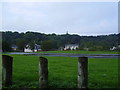
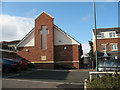
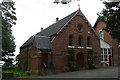
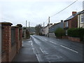
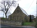
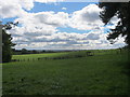
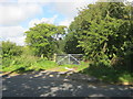
Sacriston is a small civil parish in England covering just 4.1 square kilometres. It is a quiet rural settlement centred on the village of Sacriston, situated near Durham. The area offers a detached, countryside lifestyle while remaining within commuting distance of larger towns. You will find a quiet residential environment defined by its modest size and sparse layout. Daily life here revolves around a close-knit community setting with limited commercial activity compared to urban centres. Many residents value the sense of isolation and peace that such a small parish provides. However, the limited area also means fewer local services and amenities within easy walking distance. You should expect to rely on vehicles for trips to shops, schools, or work outside the village. The location suits those who prefer a low-key existence without the noise and congestion of city living. It is an area where neighbours know one another and community events often bring people together in the village square or parish hall.
- Area Type
- Parish
- Area Size
- 4.1 km²
- Population
- Not available
- Population Density
- Not available
Demographics
The community in Sacriston has a distinctly older population profile. Your neighbours are likely to be mainly retired individuals or people working from home. The median age of residents is 70 years old, which is significantly higher than the national average. You will encounter very few young families or teenagers in the typical age group found in busier suburbs. Home ownership stands at 60 per cent of households, meaning most people who live here own their property outright or have a mortgage. This suggests a stable community with long-term residents who have stayed for many years. The low density of the 4.1 square kilometre area supports this demographic shift towards retirement housing. You might find that local pubs or clubs cater more to an older clientele interested in gardening, walking, or quiet social gatherings rather than nightlife. The population composition indicates a quiet, respectful neighbourhood where noise levels are generally low and the pace of life is slow.
Household Size
Accommodation Type
Tenure
Ethnic Group
Religion
Household Composition
Age
Household Deprivation
NS-SEC
Explore more demographic insights in this area
Go to Demographics tabPlanning
Planning Constraints
- Flood RiskPremium
- Ramsar Wetland SitesPremium
- Area of Outstanding Natural BeautyPremium
- Protected Nature ReservePremium
- Protected WoodlandPremium