Area Overview for Ouston (County Durham)
Photos of Ouston (County Durham)


Area Information
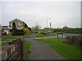
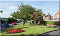
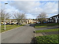
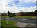
Ouston in County Durham is a built-up area of 82.6 hectares, functioning as a distinct residential community within the wider region. Living in Ouston means accessing a neighbourhood defined by its established character and proximity to larger transport hubs. The area serves as a quiet dependent locality for families and homeowners, rather than a bustling urban centre. You will find that daily life here revolves around practicality and community connection, with residents enjoying a environment sized for local interaction rather than city-scale density. The scale of 82.6 hectares indicates a settled town rather than a sprawling expansion, offering a sense of permanence that appeals to long-term residents. Those considering homes in Ouston should note the area's role as a residential base with strong links to surrounding towns. It provides a stable setting where you are not outnumbered by through-traffic or transient populations. The location is strategic enough to offer wider opportunities while maintaining a distinct local identity. You can expect a straightforward, grounded atmosphere where the focus remains on family life and stable living conditions. This is a place where you settle down, not just a place to pass through on the way to work or school.
- Area Type
- Built Up Area 250
- Area Size
- 82.6 hectares
- Population
- Not available
- Population Density
- Not available
Residents of Ouston have practical access to retail and leisure facilities in nearby towns without excessive travel. You can shop at Co-op Pelton, Morrisons Birtley, and Tesco Chester, which are within practical reach of your doorstep. These supermarkets provide a broad range of groceries and daily essentials, reducing the need for small local shops to meet every demand. For transport, five railway stations are easily accessible, including Station Road, Chester, and Bullion Lane. This rail connectivity allows you to commute quickly to Newcastle or Durham if your work requires it. Metro connections link Felling, Gateshead Stadium, and Pelaw, offering bus routes for shorter trips or those without cars. While Ouston itself may lack a large leisure complex, the nearby gateways to industrial and commercial zones provide employment and entertainment options. The presence of five retail outlets and five rail stations creates a balanced lifestyle where you can manage your day efficiently. You will find that the conveniences of larger towns are just a journey away, maintaining the quiet of Ouston while ensuring you are not cut off from the wider economy.
Amenities
Schools
Families considering Ouston will find several educational options immediately accessible to them. Ouston Infant School provides primary education for younger children in the locality. Families with older primary-age children can choose Ouston Primary School for their needs. For parents seeking a Catholic education, St Benet's Roman Catholic Voluntary Aided Primary School is available. This school holds a 'good' Ofsted rating, offering assurance of quality education for pupils in this community. The presence of both infant schools and full primary schools allows families to keep children within Ouston boundaries for their early years. The mix of denominational and non-denominational schools gives parents a choice based on educational philosophy. You do not need to commute to larger towns for primary education, as St Benet's Catholic Primary School, Ouston is located right in the area. This proximity reduces travel time for school runs and supports a consistent local community network for parents involved in school governance. The availability of multiple primary institutions means competition for local places may exist, so checking admissions policies early is advisable.
| Rank | School | Type | Entry gender | Ages |
|---|
Explore more schools in this area
Go to Schools tabDemographics
The population profile of Ouston reflects a mature community with a median age of 70 years. This statistic confirms that the most common age range includes older residents, creating a demographic dominated by retirees and families with grown children. When you buy into this area, you are likely to encounter neighbours who have settled here for decades. Home ownership stands at 77% within the area, indicating that the vast majority of households own their property outright or with a mortgage. This high level of ownership suggests financial stability among residents and a community invested in the long-term future of their streets. Accommodation types and household composition data point toward traditional family units and single-occupancy homes for the elderly. The demographic structure shows little recent migration of young professionals moving in to rent, which stabilises the local character but may constrain certain rental markets. You should expect a quieter community life where social interactions often centre around local habits rather than nightlife. The prevalence of older residents means services and local businesses may cater to those with mobility or fixed income considerations in mind.