Area Overview for Witton Gilbert
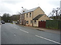
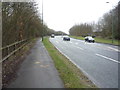
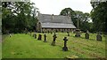
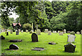
Photos of Witton Gilbert


Area Information
Living in Witton Gilbert offers a quiet experience within a civil parish covering 11.1 square kilometres. The area is significantly older than the national average, with a median age of 70 defining the local demographic. This figure indicates that the community is dominated by residents over seventy, creating a slower-paced environment compared to urban centres. You will find that daily life here revolves around stability and established routines rather than rapid change or high-energy social scenes. The low population density across this parish means you can walk to local amenities without rushing, yet you will not encounter the crowds found in larger towns. Residents here enjoy a retirement-oriented lifestyle, supported by a housing stock that primarily serves long-term ownership. The lack of major planning constraints like national park boundaries or protected wetlands means the landscape remains relatively consistent, focusing on rural corridors and settled plots. If you are considering a move, you must recognise that this is not a young-family haven; it is a sanctuary for those seeking peace and established homeownership in the North of England. ### The community in Witton Gilbert is defined by a distinctly mature population. With a median age of 70, the village functions as a retirement destination where most residents are further down the life line. Home ownership stands at 71%, reflecting a cohort that has built equity and is likely to stay put for the remainder of their days. This high rate of ownership contrasts sharply with areas where private renting or buy-to-let investments dominate the landscape. You will find that families with young children are rare here, as the balance of life stages suggests most household heads have already navigated school years and career peaks. There is no data provided on specific household composition breakdowns beyond the total figure, meaning you cannot determine the exact ratio of couples to single occupants. However, the age profile implies you will encounter a neighbourly network built on long tenure rather than transient professional moves. For anyone considering this location, the density of older residents suggests a quiet atmosphere where noise levels are kept low and social interactions are slower. The absence of significant deprivation data further indicates a stable economic base for this specific demographic group. ### The property market in Witton Gilbert is heavily skewed toward long-term ownership rather than the rental sector. A full 71% of homes fall into the owner-occupied category, creating a stable market where properties change hands less frequently than in city districts. This statistic means you are likely to deal with owners who have lived in their homes for decades, rather than landlords flipping property or agencies managing large inventories. The remaining 29% consists of other accommodation types, but the overwhelming majority of stock serves permanent residents. You should expect a range of older-built homes suitable for retirees, including bungalows and detached houses that provide single-level living. The lack of data on specific property types or price averages makes it difficult to pinpoint exact values, but the ownership dominance clearly signals a buyer's market of sorts where trades happen sporadically. If you are looking to purchase, you will compete primarily with other owners perhaps looking to downsize. The environment is not characterised by new builds or estate developments but by established gardens and settled plots that have been maintained by previous generations for a long time. ### Digital connectivity in Witton Gilbert presents a mixed picture for residents relying on remote work or heavy internet usage. Mobile coverage scores an 82 out of 100, indicating that you will generally have reliable signal for calls and data while walking around the parish. This level of connectivity supports most daily activities without significant interruption. However, fixed broadband quality is weaker, scoring only 47 out of 100. This means the internet connection speed and stability may struggle during peak use times or when streaming high-definition content. If your profession requires a robust fibre optic connection, you must test the local lines during your viewing. Many older parishes like this one often rely on older copper infrastructure rather than full fibre rollout. You might face latency issues if you attempt video conferencing over a busy network period. While mobile allows you to stay connected on the move, your home office setup requires a clear understanding of the potential limitations. Consider whether the current broadband infrastructure supports your specific work needs before committing to a property in Witton Gilbert. ### Environmental safety in Witton Gilbert is generally high, with flood risk classified as low. The area carries a score of 2.44, meaning the probability of flooding is minimal and you need not worry about water damage to your foundation or garden. There are no Ramsar wetland sites or Areas of Outstanding Natural Beauty imposing strict planning restrictions on potential home improvements. However, you must be aware of one specific environmental constraint: the parish contains protected woodland. This warning level score indicates that specific patches of trees may be legally protected, limiting your ability to clear land for construction or significant landscaping changes. You should check local maps to see if the woodland surrounds your chosen plot. On the crime front, the area scores highly on the safety scale with a crime risk score of 71. This figure reflects below-average crime rates, suggesting that night walks and daily commutes feel secure. The combination of natural protection from floods and low crime rates makes this a soft location for those prioritising physical security and a tranquil living environment. ### Is Witton Gilbert a good place for a young family? With a median age of 70, this parish is primarily a retirement community rather than a family hub. While there are no explicit bans on children, the demographic profile suggests fewer schools specifically catering to young families or extensive youth activities. The quiet, owner-occupied nature of the area appeals to retirees seeking peace. If you are moving here for school-age children, you should verify local schooling arrangements carefully, as the community is not defined by families. How reliable is the internet connection for working from home? Residents can expect decent mobile coverage with an 82 out of 100 score, making it suitable for personal use and calls. However, fixed broadband quality is rated at 47 out of 100. This lower score indicates potential issues with speed or stability if you rely heavily on the internet for daily work tasks. You should consider this limitation before choosing a property if your profession demands high-speed fibre connectivity. What are the main safety concerns when moving to Witton Gilbert? The area boasts a strong safety record with a crime risk score of 71, indicating rates well below the national average. Flood risk is also negligible at a score of 2.44, ensuring your home is safe from water ingress. The primary safety constraint stems from environmental planning; the parish contains protected woodland. This means you may face restrictions on what you can build or dig, so check your plot boundaries carefully before buying. How established is the owner-occupied market here? Ownership is deeply entrenched in this parish, with 71% of all homes occupied by their owners. This high percentage reflects a community where residents buy to stay, rather than a rental market driven by landlords. You will find that the housing stock is largely composed of established properties suited for long-term living, meaning you are likely to buy from someone looking to retire or downsize rather than a speculative investor.
- Area Type
- Parish
- Area Size
- 11.1 km²
- Population
- Not available
- Population Density
- Not available
Demographics
The community in Witton Gilbert is defined by a distinctly mature population. With a median age of 70, the village functions as a retirement destination where most residents are further down the life line. Home ownership stands at 71%, reflecting a cohort that has built equity and is likely to stay put for the remainder of their days. This high rate of ownership contrasts sharply with areas where private renting or buy-to-let investments dominate the landscape. You will find that families with young children are rare here, as the balance of life stages suggests most household heads have already navigated school years and career peaks. There is no data provided on specific household composition breakdowns beyond the total figure, meaning you cannot determine the exact ratio of couples to single occupants. However, the age profile implies you will encounter a neighbourly network built on long tenure rather than transient professional moves. For anyone considering this location, the density of older residents suggests a quiet atmosphere where noise levels are kept low and social interactions are slower. The absence of significant deprivation data further indicates a stable economic base for this specific demographic group. ### The property market in Witton Gilbert is heavily skewed toward long-term ownership rather than the rental sector. A full 71% of homes fall into the owner-occupied category, creating a stable market where properties change hands less frequently than in city districts. This statistic means you are likely to deal with owners who have lived in their homes for decades, rather than landlords flipping property or agencies managing large inventories. The remaining 29% consists of other accommodation types, but the overwhelming majority of stock serves permanent residents. You should expect a range of older-built homes suitable for retirees, including bungalows and detached houses that provide single-level living. The lack of data on specific property types or price averages makes it difficult to pinpoint exact values, but the ownership dominance clearly signals a buyer's market of sorts where trades happen sporadically. If you are looking to purchase, you will compete primarily with other owners perhaps looking to downsize. The environment is not characterised by new builds or estate developments but by established gardens and settled plots that have been maintained by previous generations for a long time. ### Digital connectivity in Witton Gilbert presents a mixed picture for residents relying on remote work or heavy internet usage. Mobile coverage scores an 82 out of 100, indicating that you will generally have reliable signal for calls and data while walking around the parish. This level of connectivity supports most daily activities without significant interruption. However, fixed broadband quality is weaker, scoring only 47 out of 100. This means the internet connection speed and stability may struggle during peak use times or when streaming high-definition content. If your profession requires a robust fibre optic connection, you must test the local lines during your viewing. Many older parishes like this one often rely on older copper infrastructure rather than full fibre rollout. You might face latency issues if you attempt video conferencing over a busy network period. While mobile allows you to stay connected on the move, your home office setup requires a clear understanding of the potential limitations. Consider whether the current broadband infrastructure supports your specific work needs before committing to a property in Witton Gilbert. ### Environmental safety in Witton Gilbert is generally high, with flood risk classified as low. The area carries a score of 2.44, meaning the probability of flooding is minimal and you need not worry about water damage to your foundation or garden. There are no Ramsar wetland sites or Areas of Outstanding Natural Beauty imposing strict planning restrictions on potential home improvements. However, you must be aware of one specific environmental constraint: the parish contains protected woodland. This warning level score indicates that specific patches of trees may be legally protected, limiting your ability to clear land for construction or significant landscaping changes. You should check local maps to see if the woodland surrounds your chosen plot. On the crime front, the area scores highly on the safety scale with a crime risk score of 71. This figure reflects below-average crime rates, suggesting that night walks and daily commutes feel secure. The combination of natural protection from floods and low crime rates makes this a soft location for those prioritising physical security and a tranquil living environment. ### Is Witton Gilbert a good place for a young family? With a median age of 70, this parish is primarily a retirement community rather than a family hub. While there are no explicit bans on children, the demographic profile suggests fewer schools specifically catering to young families or extensive youth activities. The quiet, owner-occupied nature of the area appeals to retirees seeking peace. If you are moving here for school-age children, you should verify local schooling arrangements carefully, as the community is not defined by families. How reliable is the internet connection for working from home? Residents can expect decent mobile coverage with an 82 out of 100 score, making it suitable for personal use and calls. However, fixed broadband quality is rated at 47 out of 100. This lower score indicates potential issues with speed or stability if you rely heavily on the internet for daily work tasks. You should consider this limitation before choosing a property if your profession demands high-speed fibre connectivity. What are the main safety concerns when moving to Witton Gilbert? The area boasts a strong safety record with a crime risk score of 71, indicating rates well below the national average. Flood risk is also negligible at a score of 2.44, ensuring your home is safe from water ingress. The primary safety constraint stems from environmental planning; the parish contains protected woodland. This means you may face restrictions on what you can build or dig, so check your plot boundaries carefully before buying. How established is the owner-occupied market here? Ownership is deeply entrenched in this parish, with 71% of all homes occupied by their owners. This high percentage reflects a community where residents buy to stay, rather than a rental market driven by landlords. You will find that the housing stock is largely composed of established properties suited for long-term living, meaning you are likely to buy from someone looking to retire or downsize rather than a speculative investor.
Household Size
Accommodation Type
Tenure
Ethnic Group
Religion
Household Composition
Age
Household Deprivation
NS-SEC
Explore more demographic insights in this area
Go to Demographics tabPlanning
Planning Constraints
- Flood RiskPremium
- Ramsar Wetland SitesPremium
- Area of Outstanding Natural BeautyPremium
- Protected Nature ReservePremium
- Protected WoodlandPremium