Area Overview for Stanley
Photos of Stanley


Area Information
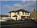
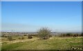
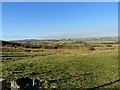
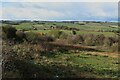
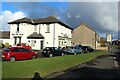
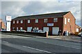
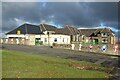
Stanley is a civil parish and commuter town located in County Durham within the North East of England. The settlement sits on a hilltop positioned between Chester-le-Street and Consett, situated some distance south-west of Gateshead. Its name derives from Old English roots meaning a stony woodland clearing. The town covers an extensive area of 36.5 square kilometres and currently houses a population of 20,341 residents. Historically, the location began as distinct mining villages that have since expanded and merged into a single urban centre. You will find historic roots dating back to 1211, with significant growth occurring during the nineteenth century following the expansion of coal mining operations. The modern community largely functions as a residential hub for those employed in surrounding industrial zones or commuting out of the area. Daily life reflects a shift away from the heavy industries that once dominated the local landscape towards a more residential character. The steep hills provided the setting for the old collieries, and while the industrial era has changed, the historical footprint remains embedded in the town's identity.
- Area Type
- Parish
- Area Size
- 36.5 km²
- Population
- 20341
- Population Density
- 557 people/km²
Demographics
The community profile of Stanley reveals a distinctly older population compared to the national average. The median age for residents stands at 70 years, indicating a demographic skewed significantly towards retirees and older adults. This age structure suggests a quiet neighbourhood dynamic rather than a bustling youth-centric environment. When you consider the population density, there are 557 people living per square kilometre across the parish. This density figure reflects a typical urban residential pattern despite the town's geographical spread. Home ownership is a prominent feature of local life, with 61 percent of households owning their properties outright or with a mortgage. This high ownership rate typically supports a stable community interested in long-term tenure rather than short-term rentals. The data indicates that the total household composition accommodates this large elderly demographic, with families likely consisting mainly of singles, couples without children, or multi-generational households. The profile paints a picture of a settled population where stability and established homes are central to the local fabric.
Household Size
Accommodation Type
Tenure
Ethnic Group
Religion
Household Composition
Age
Household Deprivation
NS-SEC
Explore more demographic insights in this area
Go to Demographics tabPlanning
Planning Constraints
- Flood RiskPremium
- Ramsar Wetland SitesPremium
- Area of Outstanding Natural BeautyPremium
- Protected Nature ReservePremium
- Protected WoodlandPremium