Area Overview for Coxhoe
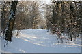
Photos of Coxhoe


Area Information
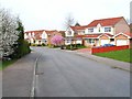
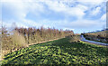
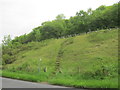
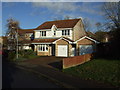
Coxhoe is a distinct civil parish situated within England, covering a total area of 4.5 km². Living in this parish offers a defined local identity away from larger urban sprawls. The community centre around a relatively small geographical footprint, which fosters a tight-knit environment for residents. You will find that daily life here is shaped by local boundaries rather than extended commuter corridors. The land itself is valuable, providing a concentrated setting for the homes and amenities found within the parish limits. Prospective homebuyers often appreciate the clarity of local governance and community focus that comes with such a specific civil parish status. The scale of the area is modest compared to major cities, yet it supports a full range of local living needs. This limitation in size often means accessing larger parks or extensive commercial zones requires travel, but it preserves a sense of containment and familiarity. When you consider homes in Coxhoe, you are looking at an established settlement with clear demarcations. The parish structure ensures that local decisions regarding housing, green spaces, and infrastructure reflect the immediate needs of the people called residents. Every plot of the 4.5 km² plays a part in the character of the area. You should expect a community where the physical limits are known and respected by those who live there.
- Area Type
- Parish
- Area Size
- 4.5 km²
- Population
- Not available
- Population Density
- Not available
Demographics
The community profile of Coxhoe is defined by a significant concentration of older residents. Census figures indicate a median age of 70 years, suggesting the neighbourhood is heavily populated by retirees rather than young families or young professionals. This demographic skew influences the local rhythm and the type of social interactions you will encounter. Most Common Age Range data categorises the population broadly, reinforcing the picture of an older population. You are likely to find neighbours who have lived in their homes for decades. Home ownership stands as the dominant mode of residence in the parish, with 65% of households owning their property outright or through mortgage. This high level of ownership contrasts sharply with rental-heavy areas where tenants move frequently. In Coxhoe, the 65% ownership rate suggests stability, as long-term residents are less prone to sudden departures. The majority of the population identifies with age groups typical of retirement life, creating a council estate feel rather than a bustling family hub. This demographic reality means that local services and commercial offerings often cater to an older clientele. When living in Coxhoe, you should expect a polite, settled atmosphere where change moves slowly. The household composition reflects traditional family structures common in retirement communities, with few adjustments for younger demographics.
Household Size
Accommodation Type
Tenure
Ethnic Group
Religion
Household Composition
Age
Household Deprivation
NS-SEC
Explore more demographic insights in this area
Go to Demographics tabPlanning
Planning Constraints
- Flood RiskPremium
- Ramsar Wetland SitesPremium
- Area of Outstanding Natural BeautyPremium
- Protected Nature ReservePremium
- Protected WoodlandPremium