Area Overview for DL17 9EY
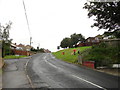
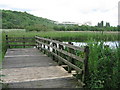
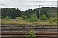
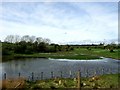
Photos of DL17 9EY


Area Information
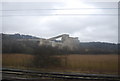
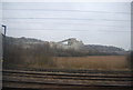
DL17 9EY is a small, compact postcode area in England, covering 1.0 km² and home to 2,425 residents. Its density of 361 people per square kilometre suggests a tightly knit community, with a mix of residential properties and local amenities. The area’s character is shaped by its demographic profile: the median age is 47, with most residents falling in the 30–64 age range. This suggests a stable, family-oriented population, likely with a focus on established housing. While the data does not specify exact historical context, the presence of protected natural areas nearby hints at a balance between rural tranquillity and accessible infrastructure. Daily life here is likely grounded in local routines, with proximity to shops, schools, and transport links. The area’s small size means residents are likely familiar with their immediate surroundings, creating a sense of cohesion. For those considering homes in DL17 9EY, the blend of modest population density and specific amenities may appeal to those seeking a quiet, manageable environment without sacrificing practicality.
- Area Type
- Postcode
- Area Size
- 1.0 km²
- Population
- 2425
- Population Density
- 361 people/km²
DL17 9EY is a predominantly owner-occupied area, with 51% of properties owned by residents. The accommodation type is largely houses, which suggests a focus on family homes rather than apartments or flats. This composition may appeal to buyers seeking traditional housing stock with potential for long-term investment. The small area size means the local property market is likely limited in scope, with limited scope for large-scale development. For buyers, this could mean competition for available homes, particularly if the area is perceived as desirable due to its amenities or proximity to protected natural sites. The presence of protected woodland and nature reserves nearby may influence planning restrictions, potentially limiting future property expansion. However, the data does not indicate current market trends, so buyers should consider local real estate dynamics independently.
House Prices in DL17 9EY
No properties found in this postcode.
Energy Efficiency in DL17 9EY
DL17 9EY offers a range of nearby amenities, including five retail outlets such as Sainsburys Ferryhill, Co-op Ferryhill, and Co-op Coxhoe. These stores provide essential shopping and grocery needs, reducing the need for long journeys to larger towns. The presence of Newton Aycliffe Railway Station adds to the area’s connectivity, enabling access to broader retail, dining, and leisure opportunities beyond the immediate postcode. While the data does not specify parks or recreational facilities, the proximity to protected woodland and nature reserves suggests potential for outdoor activities. The combination of local shops, rail access, and natural surroundings creates a lifestyle that balances convenience with access to green spaces. Residents may find daily life here practical, with amenities within practical reach for most needs.
Amenities
Schools
The nearest school to DL17 9EY is West Cornforth Primary School, which holds an Ofsted rating of outstanding. This rating suggests high standards of education and effective teaching, which is a significant draw for families. As a primary school, it serves the local community’s younger population, providing a foundation for children’s education. The absence of secondary schools in the data means families may need to look further afield for secondary education, though the proximity of the primary school reduces daily commuting for younger children. The school’s performance could be a key factor for homebuyers prioritising quality education, though the lack of additional schools nearby may influence decisions about long-term family needs.
| Rank | School | Type | Entry gender | Ages |
|---|
Explore more schools in this area
Go to Schools tabDemographics
The population of DL17 9EY is 2,425, with a median age of 47, indicating a mature demographic skewed towards adults aged 30–64. This age range suggests a community with established households, potentially including families with school-age children. Home ownership accounts for 51% of properties, with houses being the predominant accommodation type. This implies a mix of owner-occupied and rental properties, though the exact proportion of rentals is not specified. The predominant ethnic group is White, though no further breakdown of diversity is provided. The data does not include deprivation metrics, but the age profile and home ownership rate suggest a relatively stable population with a focus on long-term residency. The absence of specific diversity figures means the community’s cultural composition remains unquantified, but the area’s small size may foster a homogenous social fabric.
Household Size
Accommodation Type
Tenure
Ethnic Group
Religion
Household Composition
Age
Household Deprivation
NS-SEC
Explore more demographic insights in this area
Go to Demographics tabPlanning
Planning Constraints
- Flood RiskPremium
- Ramsar Wetland SitesPremium
- Area of Outstanding Natural BeautyPremium
- Protected Nature ReservePremium
- Protected WoodlandPremium