Area Overview for DL17 8BN
Photos of DL17 8BN

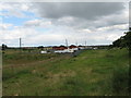
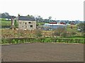
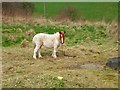
8 photos from this area
Area Information
Key information about the DL17 8BN including its size, population, and administrative classification.
- Area Type
- Postcode
- Area Size
- 1.1 km²
- Population
- 1328
- Population Density
- 381 people/km²
House Prices in DL17 8BN
38
Properties
£86,940
Average Sold Price
£26,500
Lowest Price
£157,000
Highest Price
Showing 38 properties
| Address | Type | Beds | Baths | Last Sale Price | Last Sale Date | |
|---|---|---|---|---|---|---|
| 36 Cleves Avenue, Ferryhill, DL17 8BN | Semi-detached | 3 | 1 | £157,000 | May 2025 | |
| 12 Cleves Avenue, Ferryhill, DL17 8BN | house | - | - | £137,500 | Feb 2023 | |
| 14 Cleves Avenue, Ferryhill, DL17 8BN | Semi-detached | 2 | 1 | £110,000 | Jul 2022 | |
| 26 Cleves Avenue, Ferryhill, DL17 8BN | house | - | - | £76,000 | Mar 2022 | |
| 1 Cleves Avenue, Ferryhill, DL17 8BN | Semi-detached | 3 | 1 | £118,750 | Aug 2021 | |
| 35 Cleves Avenue, Ferryhill, DL17 8BN | house | - | - | £105,000 | Jun 2021 | |
| 29 Cleves Avenue, Ferryhill, DL17 8BN | house | - | - | £106,000 | Nov 2020 | |
| 30 Cleves Avenue, Ferryhill, DL17 8BN | Semi-detached | 3 | 1 | £112,000 | Jul 2020 | |
| 24 Cleves Avenue, Ferryhill, DL17 8BN | Semi-detached | 4 | 1 | £124,950 | Jul 2016 | |
| 20 Cleves Avenue, Ferryhill, DL17 8BN | Semi-detached | 3 | 1 | £70,000 | Oct 2015 |
Page 1 of 4
Energy Efficiency in DL17 8BN
Amenities
Schools
| Rank | School | Type | Entry gender | Ages |
|---|
Explore more schools in this area
Go to Schools tabDemographics
Household Size
One person
most common
Accommodation Type
Houses
most common
Tenure
60
majority
Ethnic Group
White
most common
Religion
N/A
most common
Household Composition
N/A
most common
Age
47
median
Adults (30-64 years)
most common
Household Deprivation
N/A
with no deprivation
NS-SEC
24
in Lower managerial occupations
Explore more demographic insights in this area
Go to Demographics tabPlanning
Planning Constraints
- Flood RiskPremium
- Ramsar Wetland SitesPremium
- Area of Outstanding Natural BeautyPremium
- Protected Nature ReservePremium
- Protected WoodlandPremium