Area Overview for DL17 8DF
Photos of DL17 8DF
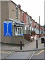
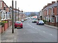
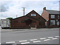
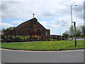
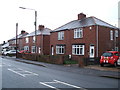
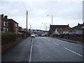
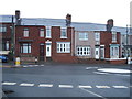
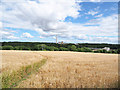
16 photos from this area
Area Information
Key information about the DL17 8DF including its size, population, and administrative classification.
- Area Type
- Postcode
- Area Size
- 9509 m²
- Population
- 1474
- Population Density
- 155015 people/km²
House Prices in DL17 8DF
29
Properties
£63,800
Average Sold Price
£23,800
Lowest Price
£88,000
Highest Price
Showing 29 properties
| Address | Type | Beds | Baths | Last Sale Price | Last Sale Date | |
|---|---|---|---|---|---|---|
| 19 Richmond Close, Ferryhill, DL17 8DF | house | - | - | £86,000 | Jul 2025 | |
| 18 Richmond Close, Ferryhill, DL17 8DF | Terraced | 3 | 1 | £85,000 | Mar 2025 | |
| 13 Richmond Close, Ferryhill, DL17 8DF | Terraced | 3 | 1 | £88,000 | Oct 2023 | |
| 22 Richmond Close, Ferryhill, DL17 8DF | Terraced | 3 | 1 | £58,000 | Aug 2021 | |
| 12 Richmond Close, Ferryhill, DL17 8DF | house | 3 | - | £42,000 | Mar 2004 | |
| 17 Richmond Close, Ferryhill, DL17 8DF | Terraced | - | - | £23,800 | Aug 1998 | |
| 24 Richmond Close, Ferryhill, DL17 8DF | Terraced | 3 | - | - | - | |
| 15 Richmond Close, Ferryhill, DL17 8DF | Terraced | 3 | 1 | - | - | |
| 20 Richmond Close, Ferryhill, DL17 8DF | Terraced | 3 | - | - | - | |
| Site Of, 11 Helmsley Close, Ferryhill, DL17 8DF | undefined | - | - | - | - |
Page 1 of 3
Energy Efficiency in DL17 8DF
Amenities
Schools
| Rank | School | Type | Entry gender | Ages |
|---|
Explore more schools in this area
Go to Schools tabDemographics
Household Size
One person
most common
Accommodation Type
Houses
most common
Tenure
61
majority
Ethnic Group
White
most common
Religion
N/A
most common
Household Composition
N/A
most common
Age
47
median
Adults (30-64 years)
most common
Household Deprivation
N/A
with no deprivation
NS-SEC
21
in Lower managerial occupations
Explore more demographic insights in this area
Go to Demographics tabPlanning
Planning Constraints
- Flood RiskPremium
- Ramsar Wetland SitesPremium
- Area of Outstanding Natural BeautyPremium
- Protected Nature ReservePremium
- Protected WoodlandPremium