Area Overview for DL1 3TU
Photos of DL1 3TU

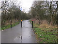
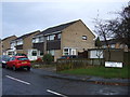
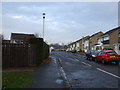
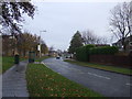
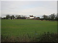
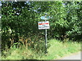
7 photos from this area
Area Information
Key information about the DL1 3TU including its size, population, and administrative classification.
- Area Type
- Postcode
- Area Size
- 3.2 hectares
- Population
- 1072
- Population Density
- 3771 people/km²
House Prices in DL1 3TU
12
Properties
£190,779
Average Sold Price
£120,000
Lowest Price
£274,950
Highest Price
Showing 12 properties
| Address | Type | Beds | Baths | Last Sale Price | Last Sale Date | |
|---|---|---|---|---|---|---|
| 3 Beauly Drive, Darlington, DL1 3TU | Detached | 4 | 2 | £249,500 | Jun 2024 | |
| 1 Beauly Drive, Darlington, DL1 3TU | house | 3 | 2 | £238,000 | Jan 2024 | |
| 2 Beauly Drive, Darlington, DL1 3TU | house | - | - | £258,000 | Jun 2021 | |
| 12 Beauly Drive, Darlington, DL1 3TU | Detached | 3 | 2 | £173,000 | Oct 2016 | |
| 4 Beauly Drive, Darlington, DL1 3TU | Detached | - | - | £174,000 | Dec 2013 | |
| 10 Beauly Drive, Darlington, DL1 3TU | house | 3 | - | £135,000 | Jan 2012 | |
| 6 Beauly Drive, Darlington, DL1 3TU | Detached | - | - | £274,950 | Jun 2006 | |
| 7 Beauly Drive, Darlington, DL1 3TU | Detached | - | - | £242,000 | Jun 2005 | |
| 8 Beauly Drive, Darlington, DL1 3TU | Detached | - | - | £177,000 | Aug 2004 | |
| 11 Beauly Drive, Darlington, DL1 3TU | Semi-detached | 3 | 2 | £124,950 | Oct 2003 |
Page 1 of 2
Energy Efficiency in DL1 3TU
Amenities
Schools
| Rank | School | Type | Entry gender | Ages |
|---|
Explore more schools in this area
Go to Schools tabDemographics
Household Size
Two person
most common
Accommodation Type
Houses
most common
Tenure
90
majority
Ethnic Group
White
most common
Religion
N/A
most common
Household Composition
N/A
most common
Age
47
median
Adults (30-64 years)
most common
Household Deprivation
N/A
with no deprivation
NS-SEC
35
in Lower managerial occupations
Explore more demographic insights in this area
Go to Demographics tabPlanning
Planning Constraints
- Flood RiskPremium
- Ramsar Wetland SitesPremium
- Area of Outstanding Natural BeautyPremium
- Protected Nature ReservePremium
- Protected WoodlandPremium