Area Overview for DL1 3TH
Photos of DL1 3TH

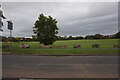
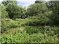
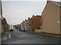


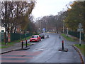
8 photos from this area
Area Information
Key information about the DL1 3TH including its size, population, and administrative classification.
- Area Type
- Postcode
- Area Size
- 1.9 hectares
- Population
- 1145
- Population Density
- 4902 people/km²
House Prices in DL1 3TH
41
Properties
£184,613
Average Sold Price
£75,000
Lowest Price
£295,000
Highest Price
Showing 41 properties
| Address | Type | Beds | Baths | Last Sale Price | Last Sale Date | |
|---|---|---|---|---|---|---|
| 34 Moray Close, Darlington, DL1 3TH | Detached | 4 | - | £295,000 | Sep 2025 | |
| 22 Moray Close, Darlington, DL1 3TH | house | 3 | 2 | £215,000 | Oct 2024 | |
| 10 Moray Close, Darlington, DL1 3TH | Detached | 4 | 2 | £230,000 | May 2024 | |
| 29 Moray Close, Darlington, DL1 3TH | Detached | 4 | 2 | £270,000 | Apr 2024 | |
| 37 Moray Close, Darlington, DL1 3TH | Retail | 4 | 2 | £252,000 | May 2022 | |
| 6 Moray Close, Darlington, DL1 3TH | house | - | - | £162,500 | Oct 2020 | |
| 1 Moray Close, Darlington, DL1 3TH | Detached | 3 | - | £225,000 | Jun 2020 | |
| 39 Moray Close, Darlington, DL1 3TH | house | - | - | £192,500 | Feb 2020 | |
| 31 Moray Close, Darlington, DL1 3TH | Detached | 3 | 1 | £188,000 | Sep 2019 | |
| 12 Moray Close, Darlington, DL1 3TH | house | - | - | £239,950 | Jul 2018 |
Page 1 of 5
Energy Efficiency in DL1 3TH
Amenities
Schools
| Rank | School | Type | Entry gender | Ages |
|---|
Explore more schools in this area
Go to Schools tabDemographics
Household Size
Two person
most common
Accommodation Type
Houses
most common
Tenure
77
majority
Ethnic Group
White
most common
Religion
N/A
most common
Household Composition
N/A
most common
Age
47
median
Adults (30-64 years)
most common
Household Deprivation
N/A
with no deprivation
NS-SEC
29
in Lower managerial occupations
Explore more demographic insights in this area
Go to Demographics tabPlanning
Planning Constraints
- Flood RiskPremium
- Ramsar Wetland SitesPremium
- Area of Outstanding Natural BeautyPremium
- Protected Nature ReservePremium
- Protected WoodlandPremium