Area Overview for DL1 2DA
Photos of DL1 2DA
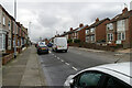
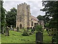
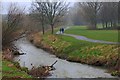
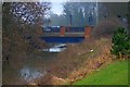
21 photos from this area
Area Information
Key information about the DL1 2DA including its size, population, and administrative classification.
- Area Type
- Postcode
- Area Size
- 1.6 hectares
- Population
- Not available
- Population Density
- Not available
House Prices in DL1 2DA
8
Properties
£98,357
Average Sold Price
£20,000
Lowest Price
£155,000
Highest Price
Showing 8 properties
| Address | Type | Beds | Baths | Last Sale Price | Last Sale Date | |
|---|---|---|---|---|---|---|
| 372 Haughton Road, Darlington, DL1 2DA | Detached | 3 | 1 | £155,000 | Sep 2025 | |
| 374 Haughton Road, Darlington, DL1 2DA | house | - | - | £135,000 | Mar 2022 | |
| 368 Haughton Road, Darlington, DL1 2DA | Semi-detached | 3 | 1 | £86,500 | Nov 2019 | |
| 380 Haughton Road, Darlington, DL1 2DA | Semi-detached | 3 | 1 | £108,000 | May 2017 | |
| 370 Haughton Road, Darlington, DL1 2DA | Semi-detached | - | - | £137,000 | Nov 2004 | |
| 378 Haughton Road, Darlington, DL1 2DA | house | - | - | £47,000 | Sep 2000 | |
| 366 Haughton Road, Darlington, DL1 2DA | house | - | - | £20,000 | Mar 1996 | |
| 376 Haughton Road, Darlington, DL1 2DA | Semi-detached | - | - | - | - |
Energy Efficiency in DL1 2DA
Amenities
Schools
| Rank | School | Type | Entry gender | Ages |
|---|
Explore more schools in this area
Go to Schools tabDemographics
Household Size
Two person
most common
Accommodation Type
Houses
most common
Tenure
60
majority
Ethnic Group
White
most common
Religion
N/A
most common
Household Composition
N/A
most common
Age
47
median
Adults (30-64 years)
most common
Household Deprivation
N/A
with no deprivation
NS-SEC
22
in Lower managerial occupations
Explore more demographic insights in this area
Go to Demographics tabPlanning
Planning Constraints
- Flood RiskPremium
- Ramsar Wetland SitesPremium
- Area of Outstanding Natural BeautyPremium
- Protected Nature ReservePremium
- Protected WoodlandPremium