Area Overview for DL1 2BL
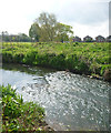
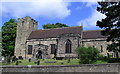
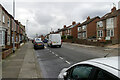
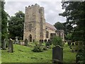
Photos of DL1 2BL


Area Information
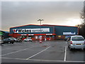
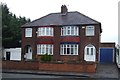
DL1 2BL is a small residential postcode area in England, home to 1,106 residents. Its compact size fosters a close-knit community feel, with homes primarily occupied by adults aged 30–64, reflecting a median age of 47. The area is characterised by a mix of family-oriented living and established households, with 60% of properties owner-occupied. Daily life here is shaped by proximity to essential services, including five retail outlets such as Spar Darlington and Morrisons, and easy access to rail networks like North Road and Darlington stations. The area’s small footprint means residents often rely on nearby towns for broader amenities, but its practical connectivity to Durham Tees Valley Airport and regional rail links ensures accessibility. With no significant environmental constraints or flood risks, DL1 2BL offers a stable base for those prioritising safety and convenience. However, the moderate crime risk score of 42/100 means residents should remain vigilant, particularly in shared spaces. For buyers seeking a quiet, family-friendly locale with straightforward infrastructure, this area provides a straightforward proposition.
- Area Type
- Postcode
- Area Size
- Not available
- Population
- Not available
- Population Density
- Not available
DL1 2BL is a small area where 60% of properties are owner-occupied, suggesting a market dominated by long-term residents rather than short-term renters. The accommodation type is predominantly houses, which contrasts with areas where flats or apartments predominate. This indicates a housing stock suited to families or individuals seeking private, standalone homes. Given the area’s limited size, the property market is unlikely to offer a wide range of options, meaning buyers may need to consider nearby postcode areas for more variety. The focus on owner-occupation also implies lower rental demand, which could influence property values and availability. For those seeking a home in a low-risk, stable environment, DL1 2BL’s housing profile offers a straightforward, if modest, selection of properties.
House Prices in DL1 2BL
Showing 1 properties
| Address | Type | Beds | Baths | Last Sale Price | Last Sale Date | |
|---|---|---|---|---|---|---|
| Amec Internal Asset Management, Red Barnes Way, Darlington, DL1 2BL | Office | - | - | - | - |
Energy Efficiency in DL1 2BL
DL1 2BL’s residents have access to a range of amenities within walking or short driving distance. Retail options include Spar Darlington, Morrisons Daily, and Iceland Yarm, catering to everyday shopping needs. The area’s rail stations provide links to nearby towns and cities, while the nearby Durham Tees Valley Airport offers regional and international travel options. Though the data does not mention parks or leisure facilities, the absence of environmental constraints like protected woodlands or AONB designations suggests open spaces may be available nearby. The combination of retail outlets, transport links, and proximity to airports ensures a practical lifestyle, though those prioritising green spaces may need to explore beyond the immediate postcode.
Amenities
Schools
DL1 2BL is served by a range of schools, including Springfield Primary School and Haughton Community School, both of which cater to younger children. For secondary and specialist education, residents have access to Beaumont Hill School, a special needs institution, and Springfield Academy and Haughton Academy, both rated ‘good’ by Ofsted. The presence of both primary and academy schools provides families with options for different stages of education. The ‘good’ ratings at the academies suggest a generally high standard of teaching, though parents should consider specific needs when choosing between schools. The mix of school types ensures coverage for children with diverse educational requirements, from mainstream learning to specialist support.
| Rank | School | Type | Entry gender | Ages |
|---|
Explore more schools in this area
Go to Schools tabDemographics
The population of DL1 2BL is predominantly adults aged 30–64, with a median age of 47. This suggests a mature, established community with a focus on long-term residency. Home ownership stands at 60%, indicating a stable housing market where most residents live in their own homes rather than renting. The accommodation type is primarily houses, reflecting a preference for single-family dwellings over flats or apartments. The predominant ethnic group is White, though no data is provided on other demographic groups or deprivation levels. The absence of specific figures on diversity or socioeconomic status means the area’s inclusivity cannot be assessed from this data alone. For those prioritising a settled, owner-occupied environment with a clear age profile, DL1 2BL aligns with a demographic that values stability over rapid change.
Household Size
Accommodation Type
Tenure
Ethnic Group
Religion
Household Composition
Age
Household Deprivation
NS-SEC
Explore more demographic insights in this area
Go to Demographics tabPlanning
Planning Constraints
- Flood RiskPremium
- Ramsar Wetland SitesPremium
- Area of Outstanding Natural BeautyPremium
- Protected Nature ReservePremium
- Protected WoodlandPremium