Area Overview for DH2 1EE
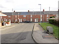
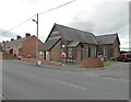
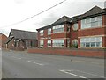
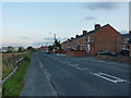
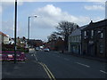
Photos of DH2 1EE


Area Information
Living in postal sector DH2 1EE offers a snapshot of life within a compact residential cluster in England. This specific postcode covers an area of just 2,422 square metres, housing a population of 1,625 people. The density is exceptionally high, reaching 671,016 people per square kilometre, which defines the character of this cluster as a tightly packed neighbourhood rather than a sprawling district. Residents here experience a community where proximity is key, yet the small geographic footprint means daily needs are concentrated. You will find a setting that functions as a distinct residential unit, separate from larger municipal divisions, yet integrated into the wider local network. The area's size limits the scope for internal leisure development, directing most activities outward to nearby towns. For anyone considering moving, the physical constraints of the area mean you are buying into a established, finite environment where the pace of life is dictated by the immediate surroundings and the transit links that connect this cluster to the rest of the region. Understanding the sheer concentration of people within these borders is essential for grasping what it means to call this location home.
- Area Type
- Postcode
- Area Size
- 2422 m²
- Population
- 1625
- Population Density
- 1785 people/km²
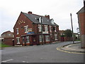
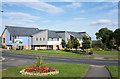
The housing portfolio for DH2 1EE is defined by single-family detached or semi-detached structures, as houses represent the primary accommodation type. With 51 per cent home ownership, the market leans heavily toward owner-occupiers rather than the private rented sector. This high ownership percentage often correlates with residents who plan to stay in the area for the long term, stabilising the local character of the cluster. Buyers looking at this micro-region should expect to compete with a demographic that values possession and permanence. Given the small footprint of just under 2,500 square metres, the inventory of available properties will be limited compared to larger urban districts. Every home here is adjacent to others, meaning there is no scope for isolation or suburban sprawl. If you are seeking a property in this postcode, you are entering a market where competition is likely stiff among local residents. The lack of variety in dwelling types, combined with the high population density, means that finding a home with specific features, such as a large garden, may require targeted searching within the immediate vicinity of this dense residential block.
House Prices in DH2 1EE
Showing 20 properties
| Address | Type | Beds | Baths | Last Sale Price | Last Sale Date | |
|---|---|---|---|---|---|---|
| 19 Wood Street, Pelton, DH2 1EE | house | 2 | - | £89,000 | Dec 2025 | |
| 8 Wood Street, Pelton, DH2 1EE | Terraced | 2 | 1 | £54,450 | Nov 2024 | |
| 5 Wood Street, Pelton, DH2 1EE | Terraced | 2 | 1 | £80,000 | Sep 2024 | |
| 2 Wood Street, Pelton, DH2 1EE | Terraced | 2 | 1 | £52,500 | Aug 2024 | |
| 1 Wood Street, Pelton, DH2 1EE | Terraced | 2 | 1 | £73,000 | Oct 2023 | |
| 10 Wood Street, Pelton, DH2 1EE | house | - | - | £61,500 | Jan 2023 | |
| 16 Wood Street, Pelton, DH2 1EE | Terraced | 2 | 1 | £75,000 | Dec 2022 | |
| 3 Wood Street, Pelton, DH2 1EE | Terraced | 2 | 1 | £57,000 | Jun 2022 | |
| 7 Wood Street, Pelton, DH2 1EE | Terraced | 2 | 1 | £60,000 | Jan 2022 | |
| 13 Wood Street, Pelton, DH2 1EE | house | 2 | 1 | £58,000 | Jan 2016 |
Energy Efficiency in DH2 1EE
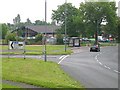
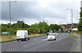
Your daily routine in DH2 1EE revolves around a series of well-placed amenities located within practical reach. Retail needs are met by five local outlets, including Co-op Pelton, Tesco Chester, and Sainsburys Chester le, eliminating the need for frequent long-distance shopping trips. For rail passengers, five station areas exist nearby on routes serving Station Road, Chester, and Bullion Lane, facilitating easy access to the wider rail network. Metro connectivity is supported by four services connecting to Felling, Gateshead Stadium, and Pelaw, offering quick access to leisure and sports facilities. Life here is about leveraging these five retail points and four metro hubs to extend your world beyond the small residential cluster. You do not need to leave the area for groceries, but you do rely on the specific named venues like Tesco Chester for bulk shopping. Dining and general commerce are concentrated in these five retail spots, meaning the residential cluster itself may lack independent cafes or clothing stores. Your lifestyle is therefore defined by the convenience of nearby high-street giants and the reliability of transport links to reach further entertainment.
Amenities
Schools
| Rank | School | Type | Entry gender | Ages |
|---|
Explore more schools in this area
Go to Schools tabDemographics
The community within DH2 1EE is shaped by a mature and established population. The median age stands at 47 years, indicating that the area has shifted toward older residents. Most commonly, households consist of adults aged between 30 and 64 years, suggesting that families have settled here or that younger adults have moved away in older age. Ownership remains a central feature of daily life, with 51 per cent of residents owning their homes outright or with a mortgage. This means the private rental market plays a secondary role in this cluster. Houses form the predominant accommodation type, aligning with the preferences of the adult demographic and the high ownership rate. The community is linguistically and culturally diverse, with the White ethnic group forming the predominant demographic. When looking at homes in this postcode sector, you are buying properties that largely correspond to long-term family units rather than transient renters. The age profile suggests a community that values stability, yet the high density implies that noise levels and neighbourly interactions are frequent and unavoidable aspects of living here.
Household Size
Accommodation Type
Tenure
Ethnic Group
Religion
Household Composition
Age
Household Deprivation
NS-SEC
Explore more demographic insights in this area
Go to Demographics tabPlanning
Planning Constraints
- Flood RiskPremium
- Ramsar Wetland SitesPremium
- Area of Outstanding Natural BeautyPremium
- Protected Nature ReservePremium
- Protected WoodlandPremium