Area Overview for DH1 5XP
Photos of DH1 5XP
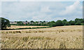
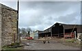
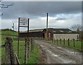
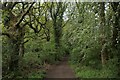
29 photos from this area
Area Information
Key information about the DH1 5XP including its size, population, and administrative classification.
- Area Type
- Postcode
- Area Size
- 2.3 hectares
- Population
- Not available
- Population Density
- Not available
House Prices in DH1 5XP
61
Properties
£97,732
Average Sold Price
£1,250
Lowest Price
£240,000
Highest Price
Showing 61 properties
| Address | Type | Beds | Baths | Last Sale Price | Last Sale Date | |
|---|---|---|---|---|---|---|
| 22 Blanchland Avenue, Newton Hall, DH1 5XP | house | - | - | £179,950 | Jun 2023 | |
| 42 Blanchland Avenue, Newton Hall, DH1 5XP | Flat | - | - | £87,500 | Apr 2023 | |
| 46 Blanchland Avenue, Newton Hall, DH1 5XP | Flat | - | - | £85,000 | Aug 2022 | |
| 55 Blanchland Avenue, Newton Hall, DH1 5XP | Flat | - | - | £57,500 | Oct 2021 | |
| 57 Blanchland Avenue, Newton Hall, DH1 5XP | Flat | - | - | £56,000 | Aug 2021 | |
| 10 Blanchland Avenue, Newton Hall, DH1 5XP | house | - | - | £202,000 | Apr 2021 | |
| 36 Blanchland Avenue, Newton Hall, DH1 5XP | Semi-detached | 3 | 1 | £130,000 | Jan 2021 | |
| 4 Blanchland Avenue, Newton Hall, DH1 5XP | Semi-detached | 3 | - | £150,000 | Sep 2018 | |
| 58 Blanchland Avenue, Newton Hall, DH1 5XP | Flat | 2 | 1 | £84,000 | Aug 2018 | |
| 53 Blanchland Avenue, Newton Hall, DH1 5XP | Flat | 2 | 1 | £68,000 | Jul 2018 |
Page 1 of 7
Energy Efficiency in DH1 5XP
Amenities
Schools
| Rank | School | Type | Entry gender | Ages |
|---|
Explore more schools in this area
Go to Schools tabDemographics
Household Size
Two person
most common
Accommodation Type
Houses
most common
Tenure
85
majority
Ethnic Group
White
most common
Religion
N/A
most common
Household Composition
N/A
most common
Age
47
median
Adults (30-64 years)
most common
Household Deprivation
N/A
with no deprivation
NS-SEC
46
in Lower managerial occupations
Explore more demographic insights in this area
Go to Demographics tabPlanning
Planning Constraints
- Flood RiskPremium
- Ramsar Wetland SitesPremium
- Area of Outstanding Natural BeautyPremium
- Protected Nature ReservePremium
- Protected WoodlandPremium