Area Overview for DH1 5SJ
Photos of DH1 5SJ


Area Information
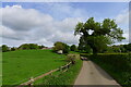
Living in DH1 5SJ means residing in a compact residential cluster covering just 1.1 square kilometres. This postcode area is home to 2,617 people, creating a community size that feels close-knit without being overstuffed. With a population density of 257 people per square kilometre, the locality balances built-up housing with enough space to avoid the congestion found in denser urban centres. The character of DH1 5SJ is defined by its intimate scale, where neighbours are likely to know one another through shared local spaces and daily routines. You will find a neighbourhood that operates more like a village than a city district, offering a quieter pace of life while maintaining access to wider regional services. The area's small footprint ensures that distances to essential facilities remain short, reducing the need for long commutes to essential services. A prospective buyer looking at DH1 5SJ should expect a setting where every hectare is utilised efficiently, providing a stable and established environment for families and individuals seeking consistency. The distinctiveness of this area lies in its manageable size and the established nature of its residential infrastructure.
- Area Type
- Postcode
- Area Size
- 1.1 km²
- Population
- 2617
- Population Density
- 257 people/km²
The property market in DH1 5SJ is overwhelmingly characterised by owner-occupation, with 81% of households owning their homes. This statistic indicates a stable market where residents have deep roots in the locality rather than transient tenants moving through frequently. Houses dominate the accommodation landscape, meaning your options will centre on detached, semi-detached, or terraced single-family properties. You are unlikely to find large complexes of flats or high-rise developments in this specific postcode cluster. The prevalence of owner-occupied homes suggests that prices may reflect long-term value retention and local improvement rather than speculative rental yields. Buyers attracted to DH1 5SJ should anticipate a market with fewer turnover transactions compared to high-rental zones. The housing stock likely includes properties built to serve nuclear families and empty nesters, given the age profile and ownership rates. When evaluating homes in DH1 5SJ, you will focus on traditional family residences that offer private gardens and independent living spaces. The consistency of the housing type supports a predictable market environment.
House Prices in DH1 5SJ
Showing 5 properties
| Address | Type | Beds | Baths | Last Sale Price | Last Sale Date | |
|---|---|---|---|---|---|---|
| Frankland Farmhouse, Frankland Lane, Durham, DH1 5SJ | house | - | - | £650,000 | Jan 2021 | |
| Frankland Farm Bungalow, Frankland Lane, Durham, DH1 5SJ | Detached | 5 | - | - | - | |
| Living Accomodation, Frankland Park, Frankland Lane, Durham, DH1 5SJ | undefined | - | - | - | - | |
| Frankland Park, Frankland Lane, Durham, DH1 5SJ | Detached | - | - | - | - | |
| Frankland Park Farmhouse, Frankland Lane, Durham, DH1 5SJ | Terraced | - | - | - | - |
Energy Efficiency in DH1 5SJ
Residents of DH1 5SJ enjoy immediate access to a selection of supermarkets and retail outlets. You can shop at Co-op Newton, Sainsburys Gilesgate, and Heron Newton without undertaking a lengthy journey. There are five retail venues within practical reach, ensuring you can purchase groceries and daily essentials quickly. For travel connections, four railway stations serve the locality, including Durham Railway Station, Bullion Lane, and Chester. These rail options provide straightforward links to wider employment hubs and leisure destinations. The nearby amenities create a functional lifestyle where routine errands and work commutes remain efficient. You will find that daily necessities are close at hand, reducing the frequency of long trips into city centres. The combination of accessible supermarkets and convenient rail links defines the practical reality of living in this area. Shopping and train travel require minimal planning for households based in DH1 5SJ.
Amenities
Schools
| Rank | School | Type | Entry gender | Ages |
|---|
Explore more schools in this area
Go to Schools tabDemographics
The community within DH1 5SJ is dominated by adults aged between 30 and 64 years, who represent the most common age range. The median age of 47 years indicates a mature demographic profile, suggesting a neighbourhood with significant stability and established families. Home ownership stands at 81%, meaning the vast majority of residents own their properties outright or have a mortgage. This high rate of ownership reflects a long-term commitment to the area and contributes to a settled atmosphere. Houses form the primary accommodation type, confirming that the area caters to single-family living rather than high-density apartment blocks. The predominant ethnic group is White, which aligns with the broader regional expectations for this postcode. You will find a population that has grown up and settled within these boundaries, creating a familiar social fabric. The age structure supports local schools and community groups that cater to young adults and older children rather than university students or young renters. This demographic reality shapes the tone of social interactions and local administration priorities.
Household Size
Accommodation Type
Tenure
Ethnic Group
Religion
Household Composition
Age
Household Deprivation
NS-SEC
Explore more demographic insights in this area
Go to Demographics tabPlanning
Planning Constraints
- Flood RiskPremium
- Ramsar Wetland SitesPremium
- Area of Outstanding Natural BeautyPremium
- Protected Nature ReservePremium
- Protected WoodlandPremium