Area Overview for W5 5LL
Photos of W5 5LL
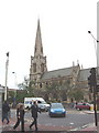
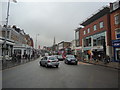

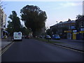
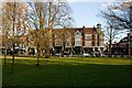


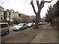

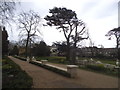
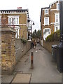
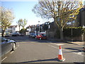
100 photos from this area
Area Information
Key information about the W5 5LL including its size, population, and administrative classification.
- Area Type
- Postcode
- Area Size
- 4259 m²
- Population
- 1860
- Population Density
- 6865 people/km²
House Prices in W5 5LL
33
Properties
£781,500
Average Sold Price
£312,000
Lowest Price
£2,030,000
Highest Price
Showing 33 properties
| Address | Type | Beds | Baths | Last Sale Price | Last Sale Date | |
|---|---|---|---|---|---|---|
| 79A The Grove, Ealing, W5 5LL | Flat | 3 | 2 | £540,000 | Jun 2023 | |
| 83 The Grove, Ealing, W5 5LL | Terraced | 5 | 2 | £2,030,000 | Sep 2022 | |
| 79 The Grove, Ealing, W5 5LL | Flat | 3 | 3 | £625,000 | Jul 2022 | |
| 69A The Grove, Ealing, W5 5LL | Flat | - | - | £312,000 | Feb 2020 | |
| 63A The Grove, Ealing, W5 5LL | Land | 1 | 1 | £1,250,000 | Jul 2019 | |
| 65A The Grove, Ealing, W5 5LL | Flat | - | - | £395,000 | May 2017 | |
| 81A The Grove, Ealing, W5 5LL | Flat | - | - | £730,000 | Aug 2014 | |
| 81 The Grove, Ealing, W5 5LL | Maisonette | 3 | 2 | £370,000 | Aug 2001 | |
| 91 The Grove, Ealing, W5 5LL | Maisonette | 3 | 3 | - | - | |
| Flat 1, 87 The Grove, Ealing, W5 5LL | Flat | 1 | 1 | - | - |
Page 1 of 4
Energy Efficiency in W5 5LL
Amenities
Schools
| Rank | School | Type | Entry gender | Ages |
|---|
Explore more schools in this area
Go to Schools tabDemographics
Household Size
Two person
most common
Accommodation Type
Flats
most common
Tenure
25
majority
Ethnic Group
White
most common
Religion
N/A
most common
Household Composition
N/A
most common
Age
47
median
Adults (30-64 years)
most common
Household Deprivation
N/A
with no deprivation
NS-SEC
46
in Lower managerial occupations
Explore more demographic insights in this area
Go to Demographics tabPlanning
Planning Constraints
- Flood RiskPremium
- Ramsar Wetland SitesPremium
- Area of Outstanding Natural BeautyPremium
- Protected Nature ReservePremium
- Protected WoodlandPremium