Area Overview for W5 3SH
Photos of W5 3SH


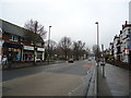


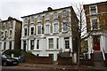


100 photos from this area
Area Information
Key information about the W5 3SH including its size, population, and administrative classification.
- Area Type
- Postcode
- Area Size
- 9026 m²
- Population
- 1476
- Population Density
- 10528 people/km²
House Prices in W5 3SH
54
Properties
£1,158,231
Average Sold Price
£151,000
Lowest Price
£3,100,000
Highest Price
Showing 54 properties
| Address | Type | Beds | Baths | Last Sale Price | Last Sale Date | |
|---|---|---|---|---|---|---|
| 134 The Grove, Ealing, W5 3SH | house | 5 | 5 | £3,100,000 | Dec 2024 | |
| 94E The Grove, Ealing, W5 3SH | Flat | - | - | £335,000 | Jun 2024 | |
| 94B The Grove, Ealing, W5 3SH | Flat | 2 | 1 | £380,000 | Dec 2023 | |
| 136 The Grove, Ealing, W5 3SH | Detached | 4 | 2 | £2,400,000 | Apr 2023 | |
| 130 The Grove, Ealing, W5 3SH | Semi-detached | 4 | 2 | £1,695,000 | Jul 2017 | |
| 138 The Grove, Ealing, W5 3SH | house | 5 | - | £1,800,000 | Jul 2011 | |
| 124 The Grove, Ealing, W5 3SH | house | 4 | - | £1,100,000 | Feb 2011 | |
| 132 The Grove, Ealing, W5 3SH | house | 5 | - | £1,055,000 | Nov 2010 | |
| 118 The Grove, Ealing, W5 3SH | house | - | - | £1,175,000 | May 2010 | |
| 120A The Grove, Ealing, W5 3SH | Flat | 1 | - | £768,000 | Oct 2002 |
Page 1 of 6
Energy Efficiency in W5 3SH
Amenities
Schools
| Rank | School | Type | Entry gender | Ages |
|---|
Explore more schools in this area
Go to Schools tabDemographics
Household Size
Two person
most common
Accommodation Type
Flats
most common
Tenure
39
majority
Ethnic Group
White
most common
Religion
N/A
most common
Household Composition
N/A
most common
Age
47
median
Adults (30-64 years)
most common
Household Deprivation
N/A
with no deprivation
NS-SEC
56
in Lower managerial occupations
Explore more demographic insights in this area
Go to Demographics tabPlanning
Planning Constraints
- Flood RiskPremium
- Ramsar Wetland SitesPremium
- Area of Outstanding Natural BeautyPremium
- Protected Nature ReservePremium
- Protected WoodlandPremium