Area Overview for W5 1SP
Photos of W5 1SP


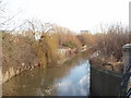
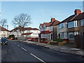


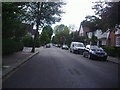
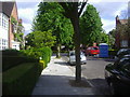


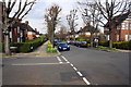
57 photos from this area
Area Information
Key information about the W5 1SP including its size, population, and administrative classification.
- Area Type
- Postcode
- Area Size
- 8373 m²
- Population
- 1573
- Population Density
- 5464 people/km²
House Prices in W5 1SP
63
Properties
£218,346
Average Sold Price
£41,090
Lowest Price
£465,000
Highest Price
Showing 63 properties
| Address | Type | Beds | Baths | Last Sale Price | Last Sale Date | |
|---|---|---|---|---|---|---|
| 5 Fairlea Place, Ealing, W5 1SP | Flat | - | - | £345,000 | Oct 2025 | |
| 61 Fairlea Place, Ealing, W5 1SP | Flat | 1 | 1 | £345,000 | Mar 2025 | |
| 62 Fairlea Place, Ealing, W5 1SP | Flat | 2 | 1 | £387,500 | Mar 2025 | |
| 39 Fairlea Place, Ealing, W5 1SP | Flat | - | - | £325,000 | Jan 2024 | |
| 31 Fairlea Place, Ealing, W5 1SP | Flat | - | - | £305,000 | Mar 2023 | |
| 59 Fairlea Place, Ealing, W5 1SP | Maisonette | 2 | 1 | £380,000 | May 2021 | |
| 37 Fairlea Place, Ealing, W5 1SP | Flat | - | - | £340,000 | Sep 2019 | |
| 12 Fairlea Place, Ealing, W5 1SP | Flat | - | - | £350,000 | Aug 2018 | |
| 24 Fairlea Place, Ealing, W5 1SP | Maisonette | 2 | 1 | £465,000 | Aug 2017 | |
| 60 Fairlea Place, Ealing, W5 1SP | Flat | 1 | 1 | £262,500 | Oct 2016 |
Page 1 of 7
Energy Efficiency in W5 1SP
Amenities
Schools
| Rank | School | Type | Entry gender | Ages |
|---|
Explore more schools in this area
Go to Schools tabDemographics
Household Size
Family (3-5 people)
most common
Accommodation Type
Houses
most common
Tenure
74
majority
Ethnic Group
White
most common
Religion
N/A
most common
Household Composition
N/A
most common
Age
47
median
Adults (30-64 years)
most common
Household Deprivation
N/A
with no deprivation
NS-SEC
58
in Lower managerial occupations
Explore more demographic insights in this area
Go to Demographics tabPlanning
Planning Constraints
- Flood RiskPremium
- Ramsar Wetland SitesPremium
- Area of Outstanding Natural BeautyPremium
- Protected Nature ReservePremium
- Protected WoodlandPremium