Area Overview for W4 5XF
Photos of W4 5XF
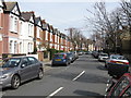
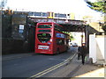

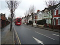
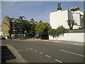
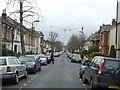
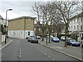
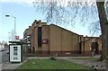
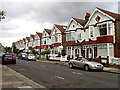
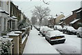
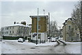
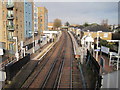
100 photos from this area
Area Information
Key information about the W4 5XF including its size, population, and administrative classification.
- Area Type
- Postcode
- Area Size
- 8418 m²
- Population
- 1707
- Population Density
- 10978 people/km²
House Prices in W4 5XF
52
Properties
£217,808
Average Sold Price
£45,000
Lowest Price
£490,000
Highest Price
Showing 52 properties
| Address | Type | Beds | Baths | Last Sale Price | Last Sale Date | |
|---|---|---|---|---|---|---|
| 121 Wilkinson Way, Chiswick, W4 5XF | Flat | - | - | £189,000 | Sep 2023 | |
| 137 Wilkinson Way, Chiswick, W4 5XF | Flat | - | 1 | £217,500 | Jul 2023 | |
| 133 Wilkinson Way, Chiswick, W4 5XF | Flat | - | - | £306,500 | Dec 2022 | |
| 163 Wilkinson Way, Chiswick, W4 5XF | Flat | - | - | £290,000 | Dec 2021 | |
| 157 Wilkinson Way, Chiswick, W4 5XF | Flat | - | - | £350,000 | Apr 2021 | |
| 89 Wilkinson Way, Chiswick, W4 5XF | Terraced | 2 | 1 | £490,000 | Mar 2021 | |
| 77 Wilkinson Way, Chiswick, W4 5XF | Flat | - | - | £362,500 | Sep 2020 | |
| 151 Wilkinson Way, Chiswick, W4 5XF | Flat | - | - | £210,000 | Oct 2019 | |
| 75 Wilkinson Way, Chiswick, W4 5XF | Flat | - | - | £345,000 | Jun 2017 | |
| 175 Wilkinson Way, Chiswick, W4 5XF | Flat | - | - | £345,000 | Feb 2017 |
Page 1 of 6
Energy Efficiency in W4 5XF
Amenities
Schools
| Rank | School | Type | Entry gender | Ages |
|---|
Explore more schools in this area
Go to Schools tabDemographics
Household Size
One person
most common
Accommodation Type
Flats
most common
Tenure
40
majority
Ethnic Group
White
most common
Religion
N/A
most common
Household Composition
N/A
most common
Age
47
median
Adults (30-64 years)
most common
Household Deprivation
N/A
with no deprivation
NS-SEC
44
in Lower managerial occupations
Explore more demographic insights in this area
Go to Demographics tabPlanning
Planning Constraints
- Flood RiskPremium
- Ramsar Wetland SitesPremium
- Area of Outstanding Natural BeautyPremium
- Protected Nature ReservePremium
- Protected WoodlandPremium