Area Overview for UB7 9JU
Photos of UB7 9JU


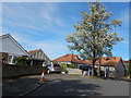
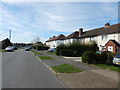
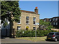
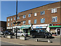


51 photos from this area
Area Information
Key information about the UB7 9JU including its size, population, and administrative classification.
- Area Type
- Postcode
- Area Size
- 1.2 hectares
- Population
- 2963
- Population Density
- 9946 people/km²
House Prices in UB7 9JU
35
Properties
£295,748
Average Sold Price
£67,000
Lowest Price
£520,000
Highest Price
Showing 35 properties
| Address | Type | Beds | Baths | Last Sale Price | Last Sale Date | |
|---|---|---|---|---|---|---|
| 26 Thornton Avenue, West Drayton, UB7 9JU | Semi-detached | 3 | 1 | £485,000 | Jul 2025 | |
| 18 Thornton Avenue, West Drayton, UB7 9JU | Semi-detached | 3 | 1 | £465,000 | Mar 2024 | |
| 73 Thornton Avenue, West Drayton, UB7 9JU | Semi-detached | 4 | 1 | £516,000 | Jan 2024 | |
| 43 Thornton Avenue, West Drayton, UB7 9JU | Semi-detached | 3 | 1 | £425,000 | Oct 2023 | |
| 30 Thornton Avenue, West Drayton, UB7 9JU | house | 3 | 2 | £520,000 | Sep 2021 | |
| 69 Thornton Avenue, West Drayton, UB7 9JU | Semi-detached | 3 | 1 | £400,000 | Jun 2021 | |
| 55 Thornton Avenue, West Drayton, UB7 9JU | Flat | - | 1 | £407,500 | May 2021 | |
| 59 Thornton Avenue, West Drayton, UB7 9JU | house | - | - | £368,000 | Feb 2021 | |
| 36 Thornton Avenue, West Drayton, UB7 9JU | Semi-detached | 3 | 1 | £367,000 | Jun 2018 | |
| 71 Thornton Avenue, West Drayton, UB7 9JU | Semi-detached | 2 | - | £355,000 | Nov 2015 |
Page 1 of 4
Energy Efficiency in UB7 9JU
Amenities
Schools
| Rank | School | Type | Entry gender | Ages |
|---|
Explore more schools in this area
Go to Schools tabDemographics
Household Size
Family (3-5 people)
most common
Accommodation Type
Houses
most common
Tenure
45
majority
Ethnic Group
White
most common
Religion
N/A
most common
Household Composition
N/A
most common
Age
47
median
Adults (30-64 years)
most common
Household Deprivation
N/A
with no deprivation
NS-SEC
33
in Lower managerial occupations
Explore more demographic insights in this area
Go to Demographics tabPlanning
Planning Constraints
- Flood RiskPremium
- Ramsar Wetland SitesPremium
- Area of Outstanding Natural BeautyPremium
- Protected Nature ReservePremium
- Protected WoodlandPremium