Area Overview for UB7 9JT
Photos of UB7 9JT


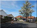
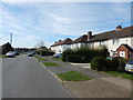
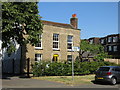
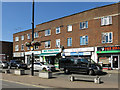

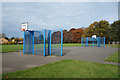


51 photos from this area
Area Information
Key information about the UB7 9JT including its size, population, and administrative classification.
- Area Type
- Postcode
- Area Size
- 8521 m²
- Population
- 2963
- Population Density
- 9946 people/km²
House Prices in UB7 9JT
26
Properties
£258,590
Average Sold Price
£65,000
Lowest Price
£460,000
Highest Price
Showing 26 properties
| Address | Type | Beds | Baths | Last Sale Price | Last Sale Date | |
|---|---|---|---|---|---|---|
| 6 Thornton Avenue, West Drayton, UB7 9JT | Semi-detached | 3 | 1 | £445,000 | Dec 2022 | |
| 5 Thornton Avenue, West Drayton, UB7 9JT | Semi-detached | 4 | - | £272,900 | Sep 2022 | |
| 4 Thornton Avenue, West Drayton, UB7 9JT | Semi-detached | 3 | 5 | £460,000 | Mar 2022 | |
| 11 Thornton Avenue, West Drayton, UB7 9JT | Semi-detached | 3 | 1 | £411,000 | Jun 2021 | |
| 14 Thornton Avenue, West Drayton, UB7 9JT | Semi-detached | 3 | 1 | £375,000 | Dec 2019 | |
| 31 Thornton Avenue, West Drayton, UB7 9JT | Semi-detached | 3 | 1 | £250,000 | Oct 2013 | |
| 12 Thornton Avenue, West Drayton, UB7 9JT | Semi-detached | 3 | 1 | £245,000 | Aug 2013 | |
| 25 Thornton Avenue, West Drayton, UB7 9JT | house | 3 | - | £225,000 | May 2012 | |
| 29 Thornton Avenue, West Drayton, UB7 9JT | Semi-detached | - | - | £225,000 | Jan 2008 | |
| 21 Thornton Avenue, West Drayton, UB7 9JT | Semi-detached | 3 | 1 | £245,000 | Nov 2007 |
Page 1 of 3
Energy Efficiency in UB7 9JT
Amenities
Schools
| Rank | School | Type | Entry gender | Ages |
|---|
Explore more schools in this area
Go to Schools tabDemographics
Household Size
Family (3-5 people)
most common
Accommodation Type
Houses
most common
Tenure
45
majority
Ethnic Group
White
most common
Religion
N/A
most common
Household Composition
N/A
most common
Age
47
median
Adults (30-64 years)
most common
Household Deprivation
N/A
with no deprivation
NS-SEC
33
in Lower managerial occupations
Explore more demographic insights in this area
Go to Demographics tabPlanning
Planning Constraints
- Flood RiskPremium
- Ramsar Wetland SitesPremium
- Area of Outstanding Natural BeautyPremium
- Protected Nature ReservePremium
- Protected WoodlandPremium