Area Overview for UB7 9HU
Photos of UB7 9HU
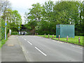
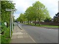
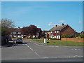
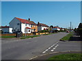
36 photos from this area
Area Information
Key information about the UB7 9HU including its size, population, and administrative classification.
- Area Type
- Postcode
- Area Size
- 4071 m²
- Population
- 1769
- Population Density
- 9180 people/km²
House Prices in UB7 9HU
28
Properties
£189,083
Average Sold Price
£142,500
Lowest Price
£270,000
Highest Price
Showing 28 properties
| Address | Type | Beds | Baths | Last Sale Price | Last Sale Date | |
|---|---|---|---|---|---|---|
| 229 Wordsworth Way, West Drayton, UB7 9HU | Flat | 2 | 1 | £270,000 | May 2020 | |
| 191 Wordsworth Way, West Drayton, UB7 9HU | Flat | - | - | £225,000 | Mar 2018 | |
| 237 Wordsworth Way, West Drayton, UB7 9HU | Maisonette | - | - | £190,000 | Apr 2015 | |
| 209 Wordsworth Way, West Drayton, UB7 9HU | Flat | - | - | £160,000 | Oct 2010 | |
| 201 Wordsworth Way, West Drayton, UB7 9HU | Maisonette | - | - | £142,500 | Dec 2004 | |
| 225 Wordsworth Way, West Drayton, UB7 9HU | Flat | - | - | £147,000 | Oct 2004 | |
| 223 Wordsworth Way, West Drayton, UB7 9HU | Flat | - | - | - | - | |
| 203 Wordsworth Way, West Drayton, UB7 9HU | Flat | - | - | - | - | |
| 231 Wordsworth Way, West Drayton, UB7 9HU | Flat | - | - | - | - | |
| 233 Wordsworth Way, West Drayton, UB7 9HU | Flat | - | - | - | - |
Page 1 of 3
Energy Efficiency in UB7 9HU
Amenities
Schools
| Rank | School | Type | Entry gender | Ages |
|---|
Explore more schools in this area
Go to Schools tabDemographics
Household Size
Family (3-5 people)
most common
Accommodation Type
Houses
most common
Tenure
37
majority
Ethnic Group
White
most common
Religion
N/A
most common
Household Composition
N/A
most common
Age
47
median
Adults (30-64 years)
most common
Household Deprivation
N/A
with no deprivation
NS-SEC
21
in Lower managerial occupations
Explore more demographic insights in this area
Go to Demographics tabPlanning
Planning Constraints
- Flood RiskPremium
- Ramsar Wetland SitesPremium
- Area of Outstanding Natural BeautyPremium
- Protected Nature ReservePremium
- Protected WoodlandPremium