Area Overview for UB7 9DS
Photos of UB7 9DS

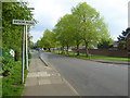
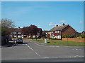
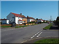
36 photos from this area
Area Information
Key information about the UB7 9DS including its size, population, and administrative classification.
- Area Type
- Postcode
- Area Size
- 1.1 hectares
- Population
- 1965
- Population Density
- 1006 people/km²
House Prices in UB7 9DS
36
Properties
£350,286
Average Sold Price
£67,500
Lowest Price
£517,000
Highest Price
Showing 36 properties
| Address | Type | Beds | Baths | Last Sale Price | Last Sale Date | |
|---|---|---|---|---|---|---|
| 39 Keats Way, West Drayton, UB7 9DS | Semi-detached | 3 | 1 | £450,000 | Jul 2024 | |
| 38 Keats Way, West Drayton, UB7 9DS | Terraced | 2 | 1 | £390,000 | Feb 2024 | |
| 49 KEATS WAY, West Drayton, UB7 9DS | Semi-detached | 3 | 1 | £494,000 | Jan 2023 | |
| 48 Keats Way, West Drayton, UB7 9DS | Terraced | 3 | 3 | £517,000 | Feb 2022 | |
| 22 Keats Way, West Drayton, UB7 9DS | Terraced | 1 | 2 | £465,000 | Jun 2021 | |
| 30 Keats Way, West Drayton, UB7 9DS | house | - | - | £470,000 | Feb 2021 | |
| 31 Keats Way, West Drayton, UB7 9DS | Semi-detached | 4 | 2 | £475,000 | Aug 2020 | |
| 23 Keats Way, West Drayton, UB7 9DS | Semi-detached | 4 | 2 | £424,000 | Feb 2019 | |
| 32 Keats Way, West Drayton, UB7 9DS | Terraced | 4 | - | £470,000 | Oct 2018 | |
| 37 Keats Way, West Drayton, UB7 9DS | Semi-detached | 3 | 1 | £410,000 | Jan 2018 |
Page 1 of 4
Energy Efficiency in UB7 9DS
Amenities
Schools
| Rank | School | Type | Entry gender | Ages |
|---|
Explore more schools in this area
Go to Schools tabDemographics
Household Size
Family (3-5 people)
most common
Accommodation Type
Houses
most common
Tenure
44
majority
Ethnic Group
White
most common
Religion
N/A
most common
Household Composition
N/A
most common
Age
47
median
Adults (30-64 years)
most common
Household Deprivation
N/A
with no deprivation
NS-SEC
23
in Lower managerial occupations
Explore more demographic insights in this area
Go to Demographics tabPlanning
Planning Constraints
- Flood RiskPremium
- Ramsar Wetland SitesPremium
- Area of Outstanding Natural BeautyPremium
- Protected Nature ReservePremium
- Protected WoodlandPremium