Area Overview for UB7 9DN
Photos of UB7 9DN
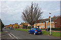
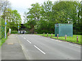
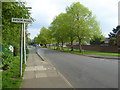
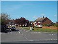
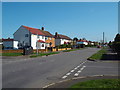
36 photos from this area
Area Information
Key information about the UB7 9DN including its size, population, and administrative classification.
- Area Type
- Postcode
- Area Size
- 7908 m²
- Population
- 1965
- Population Density
- 1006 people/km²
House Prices in UB7 9DN
23
Properties
£315,869
Average Sold Price
£83,950
Lowest Price
£500,000
Highest Price
Showing 23 properties
| Address | Type | Beds | Baths | Last Sale Price | Last Sale Date | |
|---|---|---|---|---|---|---|
| 122 Sipson Road, West Drayton, UB7 9DN | house | 3 | - | £500,000 | Feb 2024 | |
| 116 Sipson Road, West Drayton, UB7 9DN | house | - | - | £465,000 | Jun 2021 | |
| 108 Sipson Road, West Drayton, UB7 9DN | Semi-detached | 3 | 1 | £430,000 | Aug 2019 | |
| 144 Sipson Road, West Drayton, UB7 9DN | Detached | 3 | 2 | £480,000 | Jul 2019 | |
| 118 Sipson Road, West Drayton, UB7 9DN | Semi-detached | 3 | 1 | £410,000 | Oct 2016 | |
| 120 Sipson Road, West Drayton, UB7 9DN | Semi-detached | 3 | 1 | £440,000 | Aug 2016 | |
| 142 Sipson Road, West Drayton, UB7 9DN | Semi-detached | 3 | 1 | £419,500 | Jul 2016 | |
| 126 Sipson Road, West Drayton, UB7 9DN | Semi-detached | 2 | - | £319,950 | Jun 2015 | |
| 130 Sipson Road, West Drayton, UB7 9DN | Semi-detached | 3 | 1 | £250,000 | Jul 2013 | |
| 132 Sipson Road, West Drayton, UB7 9DN | Semi-detached | 4 | 2 | £212,000 | Dec 2012 |
Page 1 of 3
Energy Efficiency in UB7 9DN
Amenities
Schools
| Rank | School | Type | Entry gender | Ages |
|---|
Explore more schools in this area
Go to Schools tabDemographics
Household Size
Family (3-5 people)
most common
Accommodation Type
Houses
most common
Tenure
44
majority
Ethnic Group
White
most common
Religion
N/A
most common
Household Composition
N/A
most common
Age
47
median
Adults (30-64 years)
most common
Household Deprivation
N/A
with no deprivation
NS-SEC
23
in Lower managerial occupations
Explore more demographic insights in this area
Go to Demographics tabPlanning
Planning Constraints
- Flood RiskPremium
- Ramsar Wetland SitesPremium
- Area of Outstanding Natural BeautyPremium
- Protected Nature ReservePremium
- Protected WoodlandPremium