Area Overview for UB7 8EY
Photos of UB7 8EY
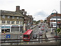
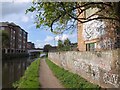
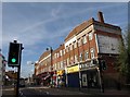
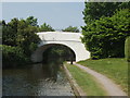
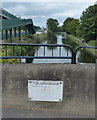
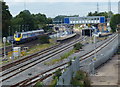
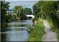
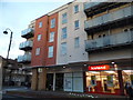
100 photos from this area
Area Information
Key information about the UB7 8EY including its size, population, and administrative classification.
- Area Type
- Postcode
- Area Size
- 1.0 hectares
- Population
- 1976
- Population Density
- 11748 people/km²
House Prices in UB7 8EY
42
Properties
£194,000
Average Sold Price
£63,000
Lowest Price
£455,000
Highest Price
Showing 42 properties
| Address | Type | Beds | Baths | Last Sale Price | Last Sale Date | |
|---|---|---|---|---|---|---|
| 19 Fairfield Road, West Drayton, UB7 8EY | Flat | 2 | 1 | £220,000 | Mar 2025 | |
| 45 Fairfield Road, West Drayton, UB7 8EY | house | - | - | £455,000 | Sep 2021 | |
| 37 Fairfield Road, West Drayton, UB7 8EY | house | 1 | 1 | £430,000 | Aug 2016 | |
| 13 Fairfield Road, West Drayton, UB7 8EY | Flat | - | - | £130,000 | Jul 2015 | |
| 15 Fairfield Road, West Drayton, UB7 8EY | Flat | - | - | £132,000 | Jun 2015 | |
| 43 Fairfield Road, West Drayton, UB7 8EY | Terraced | 4 | 1 | £335,000 | Jun 2015 | |
| 11 Fairfield Road, West Drayton, UB7 8EY | Flat | - | - | £131,000 | Jun 2015 | |
| 17 Fairfield Road, West Drayton, UB7 8EY | Flat | - | - | £137,000 | May 2015 | |
| 21 Fairfield Road, West Drayton, UB7 8EY | Flat | 1 | 1 | £135,000 | Feb 2015 | |
| 27 Fairfield Road, West Drayton, UB7 8EY | Flat | 1 | 1 | £135,000 | Feb 2015 |
Page 1 of 5
Energy Efficiency in UB7 8EY
Amenities
Schools
| Rank | School | Type | Entry gender | Ages |
|---|
Explore more schools in this area
Go to Schools tabDemographics
Household Size
Family (3-5 people)
most common
Accommodation Type
Flats
most common
Tenure
22
majority
Ethnic Group
White
most common
Religion
N/A
most common
Household Composition
N/A
most common
Age
47
median
Adults (30-64 years)
most common
Household Deprivation
N/A
with no deprivation
NS-SEC
34
in Lower managerial occupations
Explore more demographic insights in this area
Go to Demographics tabPlanning
Planning Constraints
- Flood RiskPremium
- Ramsar Wetland SitesPremium
- Area of Outstanding Natural BeautyPremium
- Protected Nature ReservePremium
- Protected WoodlandPremium