Area Overview for UB7 7TX
Photos of UB7 7TX
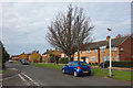

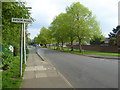
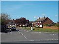
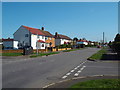
36 photos from this area
Area Information
Key information about the UB7 7TX including its size, population, and administrative classification.
- Area Type
- Postcode
- Area Size
- 4.6 hectares
- Population
- 1802
- Population Density
- 3534 people/km²
House Prices in UB7 7TX
20
Properties
£256,392
Average Sold Price
£167,000
Lowest Price
£445,000
Highest Price
Showing 20 properties
| Address | Type | Beds | Baths | Last Sale Price | Last Sale Date | |
|---|---|---|---|---|---|---|
| 46 Laurel Lane, West Drayton, UB7 7TX | house | - | - | £445,000 | Dec 2020 | |
| 44 Laurel Lane, West Drayton, UB7 7TX | Semi-detached | 2 | 1 | £360,000 | May 2017 | |
| 15 Laurel Lane, West Drayton, UB7 7TX | Terraced | 3 | 1 | £313,000 | Jun 2015 | |
| 5 Laurel Lane, West Drayton, UB7 7TX | house | - | - | £285,000 | Nov 2014 | |
| 1 Laurel Lane, West Drayton, UB7 7TX | Terraced | 3 | - | £280,000 | May 2014 | |
| 19 Laurel Lane, West Drayton, UB7 7TX | house | - | - | £207,000 | Feb 2014 | |
| 38 Laurel Lane, West Drayton, UB7 7TX | house | 2 | - | £185,500 | Jul 2012 | |
| 11 Laurel Lane, West Drayton, UB7 7TX | Semi-detached | - | - | £216,000 | Dec 2005 | |
| 36 Laurel Lane, West Drayton, UB7 7TX | Semi-detached | - | - | £179,312 | Jul 2004 | |
| 9 Laurel Lane, West Drayton, UB7 7TX | Semi-detached | - | - | £182,500 | Feb 2004 |
Page 1 of 2
Energy Efficiency in UB7 7TX
Amenities
Schools
| Rank | School | Type | Entry gender | Ages |
|---|
Explore more schools in this area
Go to Schools tabDemographics
Household Size
Family (3-5 people)
most common
Accommodation Type
Houses
most common
Tenure
68
majority
Ethnic Group
White
most common
Religion
N/A
most common
Household Composition
N/A
most common
Age
47
median
Adults (30-64 years)
most common
Household Deprivation
N/A
with no deprivation
NS-SEC
35
in Lower managerial occupations
Explore more demographic insights in this area
Go to Demographics tabPlanning
Planning Constraints
- Flood RiskPremium
- Ramsar Wetland SitesPremium
- Area of Outstanding Natural BeautyPremium
- Protected Nature ReservePremium
- Protected WoodlandPremium