Area Overview for UB7 0HR
Photos of UB7 0HR


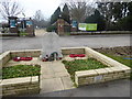

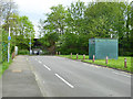
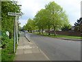
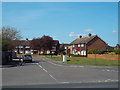
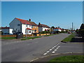
36 photos from this area
Area Information
Key information about the UB7 0HR including its size, population, and administrative classification.
- Area Type
- Postcode
- Area Size
- 17.1 hectares
- Population
- 1965
- Population Density
- 1006 people/km²
House Prices in UB7 0HR
16
Properties
£294,362
Average Sold Price
£20,000
Lowest Price
£510,000
Highest Price
Showing 16 properties
| Address | Type | Beds | Baths | Last Sale Price | Last Sale Date | |
|---|---|---|---|---|---|---|
| 384 Sipson Road, Sipson, West Drayton, UB7 0HR | Semi-detached | 4 | 1 | £510,000 | Sep 2019 | |
| 382 Sipson Road, Sipson, West Drayton, UB7 0HR | Detached | 3 | 1 | £425,000 | Mar 2015 | |
| 376 Sipson Road, Sipson, West Drayton, UB7 0HR | Detached | 3 | 1 | £249,950 | Aug 2013 | |
| 372 Sipson Road, Sipson, West Drayton, UB7 0HR | house | - | - | £341,910 | Feb 2011 | |
| 364 Sipson Road, Sipson, West Drayton, UB7 0HR | house | - | - | £399,420 | Jan 2011 | |
| 360 Sipson Road, Sipson, West Drayton, UB7 0HR | house | - | - | £356,480 | Apr 2010 | |
| 378 Sipson Road, Sipson, West Drayton, UB7 0HR | house | - | - | £220,000 | Jul 2000 | |
| 374 Sipson Road, Sipson, West Drayton, UB7 0HR | house | - | - | £126,500 | Dec 1998 | |
| Sipson Farm Bungalow, 335 Sipson Road, Sipson, West Drayton, UB7 0HR | Bungalow | - | - | £20,000 | Jan 1997 | |
| 368 Sipson Road, Sipson, West Drayton, UB7 0HR | Semi-detached | - | - | - | - |
Page 1 of 2
Energy Efficiency in UB7 0HR
Amenities
Schools
| Rank | School | Type | Entry gender | Ages |
|---|
Explore more schools in this area
Go to Schools tabDemographics
Household Size
Family (3-5 people)
most common
Accommodation Type
Houses
most common
Tenure
44
majority
Ethnic Group
White
most common
Religion
N/A
most common
Household Composition
N/A
most common
Age
47
median
Adults (30-64 years)
most common
Household Deprivation
N/A
with no deprivation
NS-SEC
23
in Lower managerial occupations
Explore more demographic insights in this area
Go to Demographics tabPlanning
Planning Constraints
- Flood RiskPremium
- Ramsar Wetland SitesPremium
- Area of Outstanding Natural BeautyPremium
- Protected Nature ReservePremium
- Protected WoodlandPremium