Area Overview for UB7 0AE
Photos of UB7 0AE
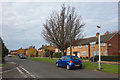
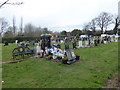
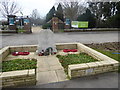

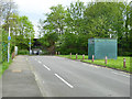
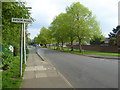
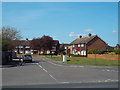
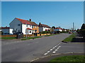
36 photos from this area
Area Information
Key information about the UB7 0AE including its size, population, and administrative classification.
- Area Type
- Postcode
- Area Size
- 14.5 hectares
- Population
- 1965
- Population Density
- 1006 people/km²
House Prices in UB7 0AE
20
Properties
£333,179
Average Sold Price
£132,500
Lowest Price
£535,000
Highest Price
Showing 20 properties
| Address | Type | Beds | Baths | Last Sale Price | Last Sale Date | |
|---|---|---|---|---|---|---|
| 39 Holloway Lane, West Drayton, UB7 0AE | house | - | - | £431,000 | Nov 2021 | |
| 24 Holloway Lane, West Drayton, UB7 0AE | Semi-detached | 4 | - | £535,000 | Mar 2021 | |
| 30 Holloway Lane, West Drayton, UB7 0AE | Semi-detached | 3 | 1 | £380,000 | Jun 2019 | |
| 27 Holloway Lane, West Drayton, UB7 0AE | house | - | - | £338,630 | Jul 2011 | |
| 20 Holloway Lane, West Drayton, UB7 0AE | house | 3 | 1 | £322,750 | Nov 2010 | |
| 22 Holloway Lane, West Drayton, UB7 0AE | house | - | - | £298,730 | Jul 2010 | |
| 25 Holloway Lane, West Drayton, UB7 0AE | house | - | - | £491,070 | Jun 2010 | |
| 33 Holloway Lane, West Drayton, UB7 0AE | house | - | - | £379,290 | Apr 2010 | |
| 26 Holloway Lane, West Drayton, UB7 0AE | Flat | - | - | £222,000 | Oct 2002 | |
| 41 Holloway Lane, West Drayton, UB7 0AE | Semi-detached | 2 | - | £132,500 | Jul 2001 |
Page 1 of 2
Energy Efficiency in UB7 0AE
Amenities
Schools
| Rank | School | Type | Entry gender | Ages |
|---|
Explore more schools in this area
Go to Schools tabDemographics
Household Size
Family (3-5 people)
most common
Accommodation Type
Houses
most common
Tenure
44
majority
Ethnic Group
White
most common
Religion
N/A
most common
Household Composition
N/A
most common
Age
47
median
Adults (30-64 years)
most common
Household Deprivation
N/A
with no deprivation
NS-SEC
23
in Lower managerial occupations
Explore more demographic insights in this area
Go to Demographics tabPlanning
Planning Constraints
- Flood RiskPremium
- Ramsar Wetland SitesPremium
- Area of Outstanding Natural BeautyPremium
- Protected Nature ReservePremium
- Protected WoodlandPremium