Area Overview for UB5 6TG
Photos of UB5 6TG
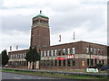
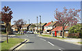


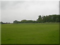
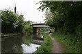
100 photos from this area
Area Information
Key information about the UB5 6TG including its size, population, and administrative classification.
- Area Type
- Postcode
- Area Size
- 6281 m²
- Population
- 1947
- Population Density
- 5932 people/km²
House Prices in UB5 6TG
15
Properties
£164,563
Average Sold Price
£72,500
Lowest Price
£225,000
Highest Price
Showing 15 properties
| Address | Type | Beds | Baths | Last Sale Price | Last Sale Date | |
|---|---|---|---|---|---|---|
| 3 Hermes Walk, Northolt, UB5 6TG | Flat | - | - | £225,000 | Nov 2015 | |
| 11 Hermes Walk, Northolt, UB5 6TG | Maisonette | 3 | 2 | £202,000 | Oct 2013 | |
| 12 Hermes Walk, Northolt, UB5 6TG | house | - | - | £220,000 | Sep 2011 | |
| 8 Hermes Walk, Northolt, UB5 6TG | house | - | - | £211,000 | Jul 2008 | |
| 9 Hermes Walk, Northolt, UB5 6TG | Flat | - | 1 | £156,000 | Jul 2003 | |
| 10 Hermes Walk, Northolt, UB5 6TG | Terraced | 1 | 1 | £125,000 | Apr 2001 | |
| 14 Hermes Walk, Northolt, UB5 6TG | house | - | - | £105,000 | Mar 2000 | |
| 4 Hermes Walk, Northolt, UB5 6TG | house | - | - | £72,500 | Mar 1996 | |
| 6 Hermes Walk, Northolt, UB5 6TG | house | 3 | 1 | - | - | |
| 1 Hermes Walk, Northolt, UB5 6TG | Maisonette | - | 1 | - | - |
Page 1 of 2
Energy Efficiency in UB5 6TG
Amenities
Schools
| Rank | School | Type | Entry gender | Ages |
|---|
Explore more schools in this area
Go to Schools tabDemographics
Household Size
Family (3-5 people)
most common
Accommodation Type
Flats
most common
Tenure
42
majority
Ethnic Group
White
most common
Religion
N/A
most common
Household Composition
N/A
most common
Age
47
median
Adults (30-64 years)
most common
Household Deprivation
N/A
with no deprivation
NS-SEC
23
in Lower managerial occupations
Explore more demographic insights in this area
Go to Demographics tabPlanning
Planning Constraints
- Flood RiskPremium
- Ramsar Wetland SitesPremium
- Area of Outstanding Natural BeautyPremium
- Protected Nature ReservePremium
- Protected WoodlandPremium