Area Overview for UB5 6AL
Photos of UB5 6AL
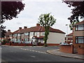
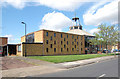
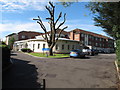
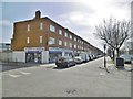
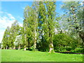
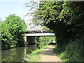
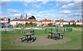
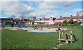
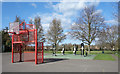
43 photos from this area
Area Information
Key information about the UB5 6AL including its size, population, and administrative classification.
- Area Type
- Postcode
- Area Size
- 1.4 hectares
- Population
- 1612
- Population Density
- 8109 people/km²
House Prices in UB5 6AL
21
Properties
£273,154
Average Sold Price
£87,000
Lowest Price
£490,000
Highest Price
Showing 21 properties
| Address | Type | Beds | Baths | Last Sale Price | Last Sale Date | |
|---|---|---|---|---|---|---|
| 25 Kensington Road, Northolt, UB5 6AL | Terraced | 3 | 1 | £490,000 | Jul 2024 | |
| 2 Kensington Road, Northolt, UB5 6AL | house | - | - | £340,000 | Jul 2021 | |
| 6 Kensington Road, Northolt, UB5 6AL | house | - | - | £365,000 | Jun 2019 | |
| 31 Kensington Road, Northolt, UB5 6AL | Semi-detached | 4 | 2 | £475,000 | Jun 2018 | |
| 4 Kensington Road, Northolt, UB5 6AL | house | 4 | - | £325,000 | Feb 2012 | |
| 27 Kensington Road, Northolt, UB5 6AL | Semi-detached | - | - | £310,000 | Sep 2008 | |
| 19 Kensington Road, Northolt, UB5 6AL | house | - | - | £267,000 | Aug 2008 | |
| 15 Kensington Road, Northolt, UB5 6AL | house | - | - | £210,000 | Aug 2006 | |
| 11 Kensington Road, Northolt, UB5 6AL | Terraced | 4 | 1 | £261,000 | Dec 2005 | |
| 17 Kensington Road, Northolt, UB5 6AL | house | - | - | £140,000 | Sep 2001 |
Page 1 of 3
Energy Efficiency in UB5 6AL
Amenities
Schools
| Rank | School | Type | Entry gender | Ages |
|---|
Explore more schools in this area
Go to Schools tabDemographics
Household Size
Family (3-5 people)
most common
Accommodation Type
Flats
most common
Tenure
43
majority
Ethnic Group
asian_total
most common
Religion
N/A
most common
Household Composition
N/A
most common
Age
47
median
Adults (30-64 years)
most common
Household Deprivation
N/A
with no deprivation
NS-SEC
21
in Lower managerial occupations
Explore more demographic insights in this area
Go to Demographics tabPlanning
Planning Constraints
- Flood RiskPremium
- Ramsar Wetland SitesPremium
- Area of Outstanding Natural BeautyPremium
- Protected Nature ReservePremium
- Protected WoodlandPremium