Area Overview for UB2 4JJ
Photos of UB2 4JJ
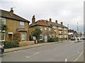
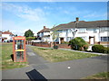
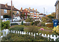
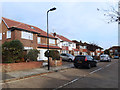
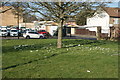
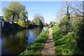
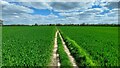
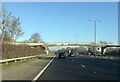
56 photos from this area
Area Information
Key information about the UB2 4JJ including its size, population, and administrative classification.
- Area Type
- Postcode
- Area Size
- 1.8 hectares
- Population
- 1841
- Population Density
- 7268 people/km²
House Prices in UB2 4JJ
28
Properties
£594,106
Average Sold Price
£149,000
Lowest Price
£1,330,000
Highest Price
Showing 28 properties
| Address | Type | Beds | Baths | Last Sale Price | Last Sale Date | |
|---|---|---|---|---|---|---|
| 309 Norwood Road, Southall, UB2 4JJ | Detached | 3 | 1 | £800,000 | Jan 2025 | |
| 293 Norwood Road, Southall, UB2 4JJ | house | 1 | 1 | £1,330,000 | Nov 2021 | |
| 307 Norwood Road, Southall, UB2 4JJ | Detached | 5 | - | £450,000 | Jun 2015 | |
| 287 Norwood Road, Southall, UB2 4JJ | house | 5 | - | £750,000 | Apr 2015 | |
| 311 Norwood Road, Southall, UB2 4JJ | Bungalow | 4 | 3 | £400,000 | Apr 2015 | |
| 285 Norwood Road, Southall, UB2 4JJ | Semi-detached | 5 | - | £650,000 | Mar 2015 | |
| 263 Norwood Road, Southall, UB2 4JJ | Detached | 6 | - | £568,000 | Jan 2007 | |
| 267 Norwood Road, Southall, UB2 4JJ | Terraced | - | - | £249,950 | Nov 1999 | |
| 297 Norwood Road, Southall, UB2 4JJ | Detached | - | - | £149,000 | Nov 1995 | |
| Norwood Green Stables, 283 Norwood Road, Southall, UB2 4JJ | Semi-detached | 5 | 3 | - | - |
Page 1 of 3
Energy Efficiency in UB2 4JJ
Amenities
Schools
| Rank | School | Type | Entry gender | Ages |
|---|
Explore more schools in this area
Go to Schools tabDemographics
Household Size
Family (3-5 people)
most common
Accommodation Type
Houses
most common
Tenure
42
majority
Ethnic Group
asian_total
most common
Religion
N/A
most common
Household Composition
N/A
most common
Age
47
median
Adults (30-64 years)
most common
Household Deprivation
N/A
with no deprivation
NS-SEC
23
in Lower managerial occupations
Explore more demographic insights in this area
Go to Demographics tabPlanning
Planning Constraints
- Flood RiskPremium
- Ramsar Wetland SitesPremium
- Area of Outstanding Natural BeautyPremium
- Protected Nature ReservePremium
- Protected WoodlandPremium