Area Overview for TW5 0HQ
Photos of TW5 0HQ
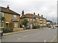
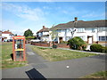
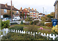
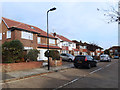

56 photos from this area
Area Information
Key information about the TW5 0HQ including its size, population, and administrative classification.
- Area Type
- Postcode
- Area Size
- 1.8 hectares
- Population
- 1623
- Population Density
- 4631 people/km²
House Prices in TW5 0HQ
10
Properties
£351,500
Average Sold Price
£116,500
Lowest Price
£915,000
Highest Price
Showing 10 properties
| Address | Type | Beds | Baths | Last Sale Price | Last Sale Date | |
|---|---|---|---|---|---|---|
| 304 Heston Road, Hounslow, TW5 0HQ | Semi-detached | 3 | 4 | £915,000 | Dec 2020 | |
| 322 Heston Road, Hounslow, TW5 0HQ | Detached | 5 | 4 | £500,000 | Aug 2013 | |
| 318 Heston Road, Hounslow, TW5 0HQ | Terraced | - | - | £305,000 | Dec 2004 | |
| 316 Heston Road, Hounslow, TW5 0HQ | Terraced | - | - | £310,000 | Aug 2004 | |
| 314 Heston Road, Hounslow, TW5 0HQ | Terraced | - | - | £321,000 | Aug 2004 | |
| 306 Heston Road, Hounslow, TW5 0HQ | Semi-detached | 4 | 2 | £177,500 | Mar 2001 | |
| 308 Heston Road, Hounslow, TW5 0HQ | Terraced | - | - | £167,000 | Nov 2000 | |
| 310 Heston Road, Hounslow, TW5 0HQ | Semi-detached | 6 | - | £116,500 | Oct 1997 | |
| 320 Heston Road, Hounslow, TW5 0HQ | Detached | - | - | - | - | |
| 312 Heston Road, Hounslow, TW5 0HQ | Terraced | - | - | - | - |
Energy Efficiency in TW5 0HQ
Amenities
Schools
| Rank | School | Type | Entry gender | Ages |
|---|
Explore more schools in this area
Go to Schools tabDemographics
Household Size
Family (3-5 people)
most common
Accommodation Type
Houses
most common
Tenure
65
majority
Ethnic Group
asian_total
most common
Religion
N/A
most common
Household Composition
N/A
most common
Age
47
median
Adults (30-64 years)
most common
Household Deprivation
N/A
with no deprivation
NS-SEC
24
in Lower managerial occupations
Explore more demographic insights in this area
Go to Demographics tabPlanning
Planning Constraints
- Flood RiskPremium
- Ramsar Wetland SitesPremium
- Area of Outstanding Natural BeautyPremium
- Protected Nature ReservePremium
- Protected WoodlandPremium