Area Overview for UB10 9PP
Photos of UB10 9PP
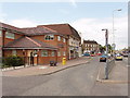
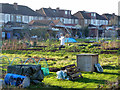

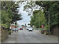
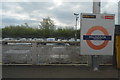

28 photos from this area
Area Information
Key information about the UB10 9PP including its size, population, and administrative classification.
- Area Type
- Postcode
- Area Size
- 5506 m²
- Population
- 1438
- Population Density
- 2536 people/km²
House Prices in UB10 9PP
37
Properties
£173,249
Average Sold Price
£80,000
Lowest Price
£208,000
Highest Price
Showing 37 properties
| Address | Type | Beds | Baths | Last Sale Price | Last Sale Date | |
|---|---|---|---|---|---|---|
| 30, Magnolia Court, Auriol Drive, Uxbridge, UB10 9PP | Flat | 1 | 1 | £160,000 | Feb 2025 | |
| 4, Magnolia Court, Auriol Drive, Uxbridge, UB10 9PP | Flat | - | - | £185,000 | Oct 2024 | |
| 29, Magnolia Court, Auriol Drive, Uxbridge, UB10 9PP | Flat | 1 | 1 | £200,000 | Sep 2024 | |
| 9, Magnolia Court, Auriol Drive, Uxbridge, UB10 9PP | Flat | 1 | 1 | £178,000 | Sep 2024 | |
| 26, Magnolia Court, Auriol Drive, Uxbridge, UB10 9PP | Maisonette | 1 | 1 | £198,500 | Mar 2024 | |
| 18, Magnolia Court, Auriol Drive, Uxbridge, UB10 9PP | Flat | - | - | £208,000 | Jan 2023 | |
| 27, Magnolia Court, Auriol Drive, Uxbridge, UB10 9PP | Flat | - | - | £200,000 | Jan 2022 | |
| 12, Magnolia Court, Auriol Drive, Uxbridge, UB10 9PP | Flat | - | - | £150,000 | Jun 2021 | |
| 21, Magnolia Court, Auriol Drive, Uxbridge, UB10 9PP | Maisonette | 1 | 1 | £185,000 | Jun 2021 | |
| 3, Magnolia Court, Auriol Drive, Uxbridge, UB10 9PP | Flat | 1 | 1 | £180,000 | Jul 2020 |
Page 1 of 4
Energy Efficiency in UB10 9PP
Amenities
Schools
| Rank | School | Type | Entry gender | Ages |
|---|
Explore more schools in this area
Go to Schools tabDemographics
Household Size
Family (3-5 people)
most common
Accommodation Type
Houses
most common
Tenure
74
majority
Ethnic Group
White
most common
Religion
N/A
most common
Household Composition
N/A
most common
Age
47
median
Adults (30-64 years)
most common
Household Deprivation
N/A
with no deprivation
NS-SEC
43
in Lower managerial occupations
Explore more demographic insights in this area
Go to Demographics tabPlanning
Planning Constraints
- Flood RiskPremium
- Ramsar Wetland SitesPremium
- Area of Outstanding Natural BeautyPremium
- Protected Nature ReservePremium
- Protected WoodlandPremium