Area Overview for UB10 9HE
Photos of UB10 9HE
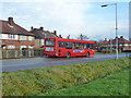
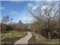
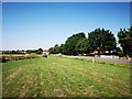
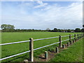
22 photos from this area
Area Information
Key information about the UB10 9HE including its size, population, and administrative classification.
- Area Type
- Postcode
- Area Size
- 9004 m²
- Population
- 1920
- Population Density
- 1163 people/km²
House Prices in UB10 9HE
41
Properties
£254,228
Average Sold Price
£72,000
Lowest Price
£540,000
Highest Price
Showing 41 properties
| Address | Type | Beds | Baths | Last Sale Price | Last Sale Date | |
|---|---|---|---|---|---|---|
| 79 Leybourne Road, Uxbridge, UB10 9HE | Flat | 1 | 1 | £221,500 | Jan 2023 | |
| 57 Leybourne Road, Uxbridge, UB10 9HE | Terraced | 3 | 2 | £540,000 | Oct 2022 | |
| 43 Leybourne Road, Uxbridge, UB10 9HE | Retail | 3 | 1 | £495,000 | Aug 2022 | |
| 67 Leybourne Road, Uxbridge, UB10 9HE | house | 3 | 1 | £350,000 | Apr 2021 | |
| 44 Leybourne Road, Uxbridge, UB10 9HE | Semi-detached | 3 | 1 | £480,557 | Nov 2020 | |
| 65 Leybourne Road, Uxbridge, UB10 9HE | house | - | - | £300,000 | Jun 2020 | |
| 36A Leybourne Road, Uxbridge, UB10 9HE | Terraced | 3 | 1 | £430,000 | Nov 2019 | |
| 75 Leybourne Road, Uxbridge, UB10 9HE | Flat | - | - | £200,000 | Feb 2019 | |
| 59 Leybourne Road, Uxbridge, UB10 9HE | Semi-detached | 3 | 1 | £405,000 | Jan 2017 | |
| 41C Leybourne Road, Uxbridge, UB10 9HE | Maisonette | 2 | 1 | £265,000 | Jan 2016 |
Page 1 of 5
Energy Efficiency in UB10 9HE
Amenities
Schools
| Rank | School | Type | Entry gender | Ages |
|---|
Explore more schools in this area
Go to Schools tabDemographics
Household Size
Family (3-5 people)
most common
Accommodation Type
Houses
most common
Tenure
63
majority
Ethnic Group
White
most common
Religion
N/A
most common
Household Composition
N/A
most common
Age
47
median
Adults (30-64 years)
most common
Household Deprivation
N/A
with no deprivation
NS-SEC
29
in Lower managerial occupations
Explore more demographic insights in this area
Go to Demographics tabPlanning
Planning Constraints
- Flood RiskPremium
- Ramsar Wetland SitesPremium
- Area of Outstanding Natural BeautyPremium
- Protected Nature ReservePremium
- Protected WoodlandPremium