Area Overview for UB10 9EZ
Photos of UB10 9EZ
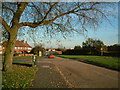
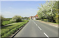

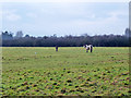
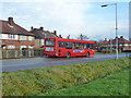
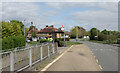
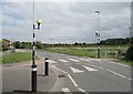
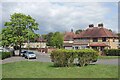
22 photos from this area
Area Information
Key information about the UB10 9EZ including its size, population, and administrative classification.
- Area Type
- Postcode
- Area Size
- 2.0 hectares
- Population
- 1920
- Population Density
- 1163 people/km²
House Prices in UB10 9EZ
40
Properties
£317,512
Average Sold Price
£57,000
Lowest Price
£555,000
Highest Price
Showing 40 properties
| Address | Type | Beds | Baths | Last Sale Price | Last Sale Date | |
|---|---|---|---|---|---|---|
| 196 Grosvenor Crescent, Uxbridge, UB10 9EZ | Semi-detached | 3 | 1 | £495,000 | Jul 2023 | |
| 190 Grosvenor Crescent, Uxbridge, UB10 9EZ | Semi-detached | 3 | 1 | £505,000 | Oct 2022 | |
| 209 Grosvenor Crescent, Uxbridge, UB10 9EZ | Terraced | 3 | 1 | £555,000 | Sep 2022 | |
| 217 Grosvenor Crescent, Uxbridge, UB10 9EZ | Terraced | 3 | 1 | £469,000 | May 2022 | |
| 223 Grosvenor Crescent, Uxbridge, UB10 9EZ | Terraced | 3 | 2 | £486,000 | Apr 2022 | |
| 195 Grosvenor Crescent, Uxbridge, UB10 9EZ | Retail | 3 | 1 | £440,000 | Mar 2022 | |
| 186 Grosvenor Crescent, Uxbridge, UB10 9EZ | Terraced | 3 | - | £477,500 | Jun 2021 | |
| 176 Grosvenor Crescent, Uxbridge, UB10 9EZ | house | 3 | - | £440,000 | Mar 2021 | |
| 186A Grosvenor Crescent, Uxbridge, UB10 9EZ | Terraced | 1 | 1 | £325,000 | Feb 2021 | |
| 205 Grosvenor Crescent, Uxbridge, UB10 9EZ | Terraced | 2 | 1 | £385,000 | Jul 2020 |
Page 1 of 4
Energy Efficiency in UB10 9EZ
Amenities
Schools
| Rank | School | Type | Entry gender | Ages |
|---|
Explore more schools in this area
Go to Schools tabDemographics
Household Size
Family (3-5 people)
most common
Accommodation Type
Houses
most common
Tenure
63
majority
Ethnic Group
White
most common
Religion
N/A
most common
Household Composition
N/A
most common
Age
47
median
Adults (30-64 years)
most common
Household Deprivation
N/A
with no deprivation
NS-SEC
29
in Lower managerial occupations
Explore more demographic insights in this area
Go to Demographics tabPlanning
Planning Constraints
- Flood RiskPremium
- Ramsar Wetland SitesPremium
- Area of Outstanding Natural BeautyPremium
- Protected Nature ReservePremium
- Protected WoodlandPremium